


Brownville Precinct, Nemaha County, Nebraska
About
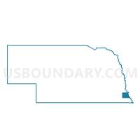
Outline

Summary
| Unique Area Identifier | 613653 |
| Name | Brownville Precinct |
| County | Nemaha County |
| State | Nebraska |
| Area (square miles) | 44.83 |
| Land Area (square miles) | 44.35 |
| Water Area (square miles) | 0.48 |
| % of Land Area | 98.92 |
| % of Water Area | 1.08 |
| Latitude of the Internal Point | 40.41442910 |
| Longtitude of the Internal Point | -95.71537350 |
Maps


Graphs
Select a template below for downloading or customizing gragh for Brownville Precinct, Nemaha County, Nebraska


Neighbors
Neighoring Voting District (by Name) Neighboring Voting District on the Map
- 1st Douglas Precinct, Nemaha County, NE
- 4th Douglas Precinct, Nemaha County, NE
- Nemaha Precinct, Nemaha County, NE
- Peru Precinct, Nemaha County, NE
- Phelps City Voting District, Atchison County, MO
- Watson Voting District, Atchison County, MO
Top 10 Neighboring County Subdivision (by Population) Neighboring County Subdivision on the Map
- Peru precinct, Nemaha County, NE (1,077)
- Brownville precinct, Nemaha County, NE (399)
- Douglas precinct, Nemaha County, NE (314)
- Nemaha precinct, Nemaha County, NE (303)
- Glen Rock precinct, Nemaha County, NE (273)
- Nishnabotna township, Atchison County, MO (155)
- Buchanan township, Atchison County, MO (83)
- Templeton township, Atchison County, MO (79)
Top 10 Neighboring Place (by Population) Neighboring Place on the Map
Top 10 Neighboring Unified School District (by Population) Neighboring Unified School District on the Map
- Auburn Public Schools, NE (5,702)
- Humboldt Table Rock Steinauer Public Schools, NE (3,300)
- Rock Port R-II School District, MO (2,329)
Top 10 Neighboring State Legislative District Lower Chamber (by Population) Neighboring State Legislative District Lower Chamber on the Map
Top 10 Neighboring State Legislative District Upper Chamber (by Population) Neighboring State Legislative District Upper Chamber on the Map
Top 10 Neighboring 111th Congressional District (by Population) Neighboring 111th Congressional District on the Map
Top 10 Neighboring Census Tract (by Population) Neighboring Census Tract on the Map
- Census Tract 9682, Nemaha County, NE (3,653)
- Census Tract 9681, Nemaha County, NE (3,595)
- Census Tract 9502, Atchison County, MO (2,470)
Top 10 Neighboring 5-Digit ZIP Code Tabulation Area (by Population) Neighboring 5-Digit ZIP Code Tabulation Area on the Map
- 68305, NE (4,389)
- 64482, MO (2,101)
- 51640, IA (1,748)
- 68421, NE (1,107)
- 68321, NE (311)
- 68414, NE (256)
- 64496, MO (154)