


East Bayard Precinct, Morrill County, Nebraska
About
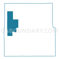
Outline

Summary
| Unique Area Identifier | 613635 |
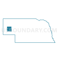
| Name | East Bayard Precinct |
| County | Morrill County |
| State | Nebraska |
| Area (square miles) | 102.48 |
| Land Area (square miles) | 102.33 |
| Water Area (square miles) | 0.15 |
| % of Land Area | 99.85 |
| % of Water Area | 0.15 |
| Latitude of the Internal Point | 41.78153550 |
| Longtitude of the Internal Point | -103.25548860 |
Maps

Graphs
Select a template below for downloading or customizing gragh for East Bayard Precinct, Morrill County, Nebraska


Neighbors
Neighoring Voting District (by Name) Neighboring Voting District on the Map
- Haynes Precinct, Morrill County, NE
- North Campe Clarke Precinct, Morrill County, NE
- Redington Precinct, Morrill County, NE
- West Bayard Precinct, Morrill County, NE
- West Camp Clarke Precinct, Morrill County, NE
Top 10 Neighboring County Subdivision (by Population) Neighboring County Subdivision on the Map
- East Bayard precinct, Morrill County, NE (1,158)
- West Bayard precinct, Morrill County, NE (852)
- West Camp Clarke precinct, Morrill County, NE (556)
- North Camp Clarke precinct, Morrill County, NE (537)
- Redington precinct, Morrill County, NE (135)
- Haynes precinct, Morrill County, NE (103)