


Fairview-Kalamazoo-Green Garden Precinct, Madison County, Nebraska
About
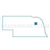
Outline

Summary
| Unique Area Identifier | 613612 |
| Name | Fairview-Kalamazoo-Green Garden Precinct |
| County | Madison County |
| State | Nebraska |
| Area (square miles) | 107.86 |
| Land Area (square miles) | 107.81 |
| Water Area (square miles) | 0.05 |
| % of Land Area | 99.95 |
| % of Water Area | 0.05 |
| Latitude of the Internal Point | 41.80805670 |
| Longtitude of the Internal Point | -97.57133490 |
Maps


Graphs
Select a template below for downloading or customizing gragh for Fairview-Kalamazoo-Green Garden Precinct, Madison County, Nebraska


Neighbors
Neighoring Voting District (by Name) Neighboring Voting District on the Map
- BC-Battle Creek Precinct, Madison County, NE
- Granville Precinct, Platte County, NE
- Humphrey Precinct, Platte County, NE
- Meadow Grove-Jefferson-Grove-Highland Precinct, Madison County, NE
- Schoolcraft-Emerick-SCrk-NG Precinct, Madison County, NE
- St. Bernard Precinct, Platte County, NE
- Union-Madison Precinct, Madison County, NE
- Walker/Woodville Precinct, Platte County, NE
- Warnerville Precinct, Madison County, NE
Top 10 Neighboring County Subdivision (by Population) Neighboring County Subdivision on the Map
- Battle Creek precinct, Madison County, NE (1,165)
- Granville township, Platte County, NE (981)
- Highland precinct, Madison County, NE (611)
- St. Bernard township, Platte County, NE (502)
- Warnerville precinct, Madison County, NE (400)
- Humphrey township, Platte County, NE (387)
- Union precinct, Madison County, NE (264)
- Walker township, Platte County, NE (247)
- Madison precinct, Madison County, NE (181)
- Fairview precinct, Madison County, NE (177)
Top 10 Neighboring Unified School District (by Population) Neighboring Unified School District on the Map
- Madison Public Schools, NE (3,548)
- Battle Creek Public Schools, NE (2,573)
- Humphrey Public Schools, NE (2,250)
- Newman Grove Public Schools, NE (1,406)
Top 10 Neighboring State Legislative District Upper Chamber (by Population) Neighboring State Legislative District Upper Chamber on the Map
Top 10 Neighboring 111th Congressional District (by Population) Neighboring 111th Congressional District on the Map
Top 10 Neighboring Census Tract (by Population) Neighboring Census Tract on the Map
- Census Tract 9613, Madison County, NE (5,009)
- Census Tract 9651, Platte County, NE (3,737)
- Census Tract 9612, Madison County, NE (3,513)
Top 10 Neighboring 5-Digit ZIP Code Tabulation Area (by Population) Neighboring 5-Digit ZIP Code Tabulation Area on the Map
- 68701, NE (30,670)
- 68748, NE (3,260)
- 68642, NE (1,721)
- 68715, NE (1,446)
- 68758, NE (1,164)
- 68644, NE (721)