


Precinct 2-1, Douglas County, Nebraska
About
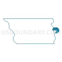
Outline

Summary
| Unique Area Identifier | 612856 |
| Name | Precinct 2-1 |
| County | Douglas County |
| State | Nebraska |
| Area (square miles) | 7.09 |
| Land Area (square miles) | 6.18 |
| Water Area (square miles) | 0.90 |
| % of Land Area | 87.23 |
| % of Water Area | 12.77 |
| Latitude of the Internal Point | 41.30250260 |
| Longtitude of the Internal Point | -95.89252080 |
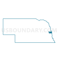
Maps

Graphs
Select a template below for downloading or customizing gragh for Precinct 2-1, Douglas County, Nebraska


Neighbors
Neighoring Voting District (by Name) Neighboring Voting District on the Map
- COUNCIL BLUFFS PCT 1 & CARTER LAKE, Pottawattamie County, IA
- LAKE TWP W/O COUNCIL BLUFFS Voting District, Pottawattamie County, IA
- Precinct 1-9, Douglas County, NE
- Precinct 2-2, Douglas County, NE
- Precinct 2-27, Douglas County, NE
- Precinct 2-29, Douglas County, NE
Top 10 Neighboring County Subdivision (by Population) Neighboring County Subdivision on the Map
- Omaha city, Douglas County, NE (408,958)
- Kane township, Pottawattamie County, IA (53,485)
- Lake township, Pottawattamie County, IA (1,104)
Top 10 Neighboring Place (by Population) Neighboring Place on the Map
Top 10 Neighboring Unified School District (by Population) Neighboring Unified School District on the Map
Top 10 Neighboring State Legislative District Lower Chamber (by Population) Neighboring State Legislative District Lower Chamber on the Map
- State House District 98, IA (32,864)
- State House District 100, IA (31,218)
- State House District 99, IA (29,553)
Top 10 Neighboring State Legislative District Upper Chamber (by Population) Neighboring State Legislative District Upper Chamber on the Map
- State Senate District 50, IA (60,771)
- State Senate District 49, IA (60,560)
- State Senate District 13, NE (36,243)
- State Senate District 11, NE (31,894)
Top 10 Neighboring 111th Congressional District (by Population) Neighboring 111th Congressional District on the Map
Top 10 Neighboring Census Tract (by Population) Neighboring Census Tract on the Map
- Census Tract 304.01, Pottawattamie County, IA (4,230)
- Census Tract 212, Pottawattamie County, IA (3,785)
- Census Tract 318, Pottawattamie County, IA (3,321)
- Census Tract 5, Douglas County, NE (2,328)
- Census Tract 4, Douglas County, NE (2,176)
- Census Tract 8, Douglas County, NE (1,861)
- Census Tract 6, Douglas County, NE (1,422)