


#7 Precinct, Dawes County, Nebraska
About
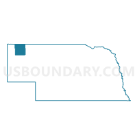
Outline

Summary
| Unique Area Identifier | 612677 |
| Name | #7 Precinct |
| County | Dawes County |
| State | Nebraska |
| Area (square miles) | 340.90 |
| Land Area (square miles) | 338.50 |
| Water Area (square miles) | 2.40 |
| % of Land Area | 99.30 |
| % of Water Area | 0.70 |
| Latitude of the Internal Point | 42.54763760 |
| Longtitude of the Internal Point | -103.11630360 |
Maps


Graphs
Select a template below for downloading or customizing gragh for #7 Precinct, Dawes County, Nebraska


Neighbors
Neighoring Voting District (by Name) Neighboring Voting District on the Map
- #10 Precinct, Dawes County, NE
- #6 Precinct, Dawes County, NE
- #8 Precinct, Dawes County, NE
- #9 Precinct, Dawes County, NE
- 15 Precinct, Box Butte County, NE
- Bowen Precinct, Sioux County, NE
- Mirage Precinct, Sheridan County, NE
Top 10 Neighboring County Subdivision (by Population) Neighboring County Subdivision on the Map
- Fifteen precinct, Box Butte County, NE (1,468)
- Precinct 10, Dawes County, NE (775)
- Precinct 06, Dawes County, NE (640)
- Precinct 07, Dawes County, NE (543)
- Precinct 08, Dawes County, NE (466)
- Mirage precinct, Sheridan County, NE (298)
- Precinct 09, Dawes County, NE (245)
- Whistle Creek precinct, Sioux County, NE (137)
Top 10 Neighboring Unified School District (by Population) Neighboring Unified School District on the Map
- Alliance Public Schools, NE (9,813)
- Chadron Public Schools, NE (7,545)
- Hemingford Public Schools, NE (1,866)
- Crawford Public Schools, NE (1,411)
- Hay Springs Public Schools, NE (1,091)
- Sioux County Public Schools, NE (870)
Top 10 Neighboring State Legislative District Upper Chamber (by Population) Neighboring State Legislative District Upper Chamber on the Map
Top 10 Neighboring 111th Congressional District (by Population) Neighboring 111th Congressional District on the Map
Top 10 Neighboring Census Tract (by Population) Neighboring Census Tract on the Map
- Census Tract 9517, Sheridan County, NE (3,254)
- Census Tract 9506, Dawes County, NE (3,013)
- Census Tract 9511, Box Butte County, NE (2,259)
- Census Tract 9501, Sioux County, NE (1,311)
Top 10 Neighboring 5-Digit ZIP Code Tabulation Area (by Population) Neighboring 5-Digit ZIP Code Tabulation Area on the Map
- 69301, NE (10,125)
- 69337, NE (7,365)
- 69348, NE (1,503)
- 69339, NE (1,462)
- 69347, NE (1,249)
- 69367, NE (259)
- 69354, NE (97)