


Bear Creek Voting District, Madison County, Mississippi
About
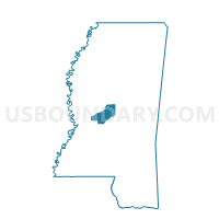
Outline

Summary
| Unique Area Identifier | 606218 |
| Name | Bear Creek Voting District |
| County | Madison County |
| State | Mississippi |
| Area (square miles) | 39.70 |
| Land Area (square miles) | 27.44 |
| Water Area (square miles) | 12.26 |
| % of Land Area | 69.12 |
| % of Water Area | 30.88 |
| Latitude of the Internal Point | 32.52431550 |
| Longtitude of the Internal Point | -90.00663600 |
Maps


Graphs
Select a template below for downloading or customizing gragh for Bear Creek Voting District, Madison County, Mississippi


Neighbors
Neighoring Voting District (by Name) Neighboring Voting District on the Map
- Canton Precinct 3, Madison County, MS
- Cedar Grove Voting District, Madison County, MS
- Fannin Voting District, Rankin County, MS
- Gluckstadt Voting District, Madison County, MS
- Liberty Voting District, Madison County, MS
- Madison 2 Voting District, Madison County, MS
- Main Harbor Voting District, Madison County, MS
- New Industrial Park Voting District, Madison County, MS
- Pisgah Voting District, Rankin County, MS
- Ratliff Ferry Voting District, Madison County, MS
- Reservoir West Voting District, Rankin County, MS
- Trace Harbor Voting District, Madison County, MS
- Yandell Road Voting District, Madison County, MS
Top 10 Neighboring County Subdivision (by Population) Neighboring County Subdivision on the Map
- District 2, Rankin County, MS (30,825)
- District 4, Rankin County, MS (29,684)
- District 3, Madison County, MS (22,721)
- District 4, Madison County, MS (20,324)
- District 2, Madison County, MS (19,318)
- District 1, Madison County, MS (17,350)
- District 5, Madison County, MS (15,490)
Top 10 Neighboring Place (by Population) Neighboring Place on the Map
Top 10 Neighboring Unified School District (by Population) Neighboring Unified School District on the Map
- Rankin County School District, MS (117,773)
- Madison County School District, MS (74,118)
- Canton Public School District, MS (21,085)
Top 10 Neighboring State Legislative District Lower Chamber (by Population) Neighboring State Legislative District Lower Chamber on the Map
- State House District 74, MS (35,304)
- State House District 59, MS (32,404)
- State House District 58, MS (28,391)
- State House District 57, MS (28,102)
- State House District 64, MS (25,444)
Top 10 Neighboring State Legislative District Upper Chamber (by Population) Neighboring State Legislative District Upper Chamber on the Map
- State Senate District 25, MS (72,122)
- State Senate District 20, MS (68,638)
- State Senate District 21, MS (51,160)
Top 10 Neighboring 111th Congressional District (by Population) Neighboring 111th Congressional District on the Map
Top 10 Neighboring Census Tract (by Population) Neighboring Census Tract on the Map
- Census Tract 304, Madison County, MS (11,995)
- Census Tract 302.01, Madison County, MS (7,667)
- Census Tract 301.01, Madison County, MS (7,285)
- Census Tract 309, Madison County, MS (5,898)
- Census Tract 201.01, Rankin County, MS (4,772)
- Census Tract 202.10, Rankin County, MS (4,522)
- Census Tract 302.04, Madison County, MS (3,853)
- Census Tract 301.07, Madison County, MS (2,721)