


Precinct 10, De Soto Parish, Louisiana
About
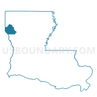
Outline

Summary
| Unique Area Identifier | 588498 |
| Name | Precinct 10 |
| County | De Soto Parish |
| State | Louisiana |
| Area (square miles) | 5.60 |
| Land Area (square miles) | 5.01 |
| Water Area (square miles) | 0.60 |
| % of Land Area | 89.34 |
| % of Water Area | 10.66 |
| Latitude of the Internal Point | 31.98108540 |
| Longtitude of the Internal Point | -94.00063400 |
Maps


Graphs
Select a template below for downloading or customizing gragh for Precinct 10, De Soto Parish, Louisiana


Neighbors
Neighoring Voting District (by Name) Neighboring Voting District on the Map
- Voting District 0005, Shelby County, TX
- Voting District 0019, Panola County, TX
- Precinct 12, De Soto Parish, LA
- Precinct 49, De Soto Parish, LA
Top 10 Neighboring County Subdivision (by Population) Neighboring County Subdivision on the Map
- Tenaha-Joaquin CCD, Shelby County, TX (5,109)
- District 1B, De Soto Parish, LA (2,357)
- Gary City CCD, Panola County, TX (2,266)
Top 10 Neighboring Place (by Population) Neighboring Place on the Map
Top 10 Neighboring Unified School District (by Population) Neighboring Unified School District on the Map
Top 10 Neighboring State Legislative District Lower Chamber (by Population) Neighboring State Legislative District Lower Chamber on the Map
- State House District 11, TX (151,703)
- State House District 9, TX (145,381)
- State House District 7, LA (44,017)
Top 10 Neighboring State Legislative District Upper Chamber (by Population) Neighboring State Legislative District Upper Chamber on the Map
- State Senate District 3, TX (818,359)
- State Senate District 1, TX (731,108)
- State Senate District 38, LA (120,165)
Top 10 Neighboring 111th Congressional District (by Population) Neighboring 111th Congressional District on the Map
Top 10 Neighboring Census Tract (by Population) Neighboring Census Tract on the Map
- Census Tract 9501, Shelby County, TX (5,109)
- Census Tract 9502, De Soto Parish, LA (4,334)
- Census Tract 9506, Panola County, TX (2,266)