


Granite Township Voting District, Phillips County, Kansas
About
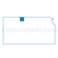
Outline

Summary
| Unique Area Identifier | 586289 |
| Name | Granite Township Voting District |
| County | Phillips County |
| State | Kansas |
| Area (square miles) | 35.63 |
| Land Area (square miles) | 35.58 |
| Water Area (square miles) | 0.05 |
| % of Land Area | 99.86 |
| % of Water Area | 0.14 |
| Latitude of the Internal Point | 39.95154700 |
| Longtitude of the Internal Point | -99.44987860 |
Maps


Graphs
Select a template below for downloading or customizing gragh for Granite Township Voting District, Phillips County, Kansas


Neighbors
Neighoring Voting District (by Name) Neighboring Voting District on the Map
- Dayton Township Voting District, Phillips County, KS
- East Alma Precinct, Harlan County, NE
- Freedom Township Voting District, Phillips County, KS
- Long Island Township Voting District, Phillips County, KS
- Orleans Precinct, Harlan County, NE
- Prairie View Township Voting District, Phillips County, KS
- Walnut Township Voting District, Phillips County, KS
Top 10 Neighboring County Subdivision (by Population) Neighboring County Subdivision on the Map
- Long Island township, Phillips County, KS (226)
- Prairie View township, Phillips County, KS (200)
- Freedom township, Phillips County, KS (90)
- Eldorado township, Harlan County, NE (56)
- Dayton township, Phillips County, KS (33)
- Prairie Dog township, Harlan County, NE (31)
- Granite township, Phillips County, KS (31)
- Walnut township, Phillips County, KS (17)
Top 10 Neighboring Unified School District (by Population) Neighboring Unified School District on the Map
- Southern Valley Schools, NE (2,895)
- Alma Public Schools, NE (1,885)
- Northern Valley Unified School District 212, KS (897)