


Sublette 1 Voting District, Haskell County, Kansas
About
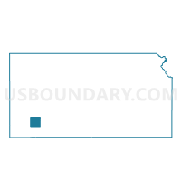
Outline

Summary
| Unique Area Identifier | 585006 |
| Name | Sublette 1 Voting District |
| County | Haskell County |
| State | Kansas |
| Area (square miles) | 85.42 |
| Land Area (square miles) | 85.39 |
| Water Area (square miles) | 0.03 |
| % of Land Area | 99.96 |
| % of Water Area | 0.04 |
| Latitude of the Internal Point | 37.46404970 |
| Longtitude of the Internal Point | -100.87551200 |
Maps


Graphs
Select a template below for downloading or customizing gragh for Sublette 1 Voting District, Haskell County, Kansas


Neighbors
Neighoring Voting District (by Name) Neighboring Voting District on the Map
- Ivanhoe Township Voting District, Haskell County, KS
- Satanta 1 Voting District, Haskell County, KS
- Satanta 2 Voting District, Haskell County, KS
- Seward Township 1 Voting District, Seward County, KS
- Seward Township 2 Voting District, Seward County, KS
- South Lockport Voting District, Haskell County, KS
- Sublette 3 Voting District, Haskell County, KS
Top 10 Neighboring County Subdivision (by Population) Neighboring County Subdivision on the Map
- Haskell township, Haskell County, KS (2,094)
- Dudley township, Haskell County, KS (1,683)
- Lockport township, Haskell County, KS (479)
- Seward township, Seward County, KS (316)