


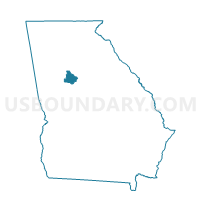
15150 - PATES CREEK Voting District, Henry County, Georgia
About
Outline

Summary
| Unique Area Identifier | 562201 |
| Name | 15150 - PATES CREEK Voting District |
| County | Henry County |
| State | Georgia |
| Area (square miles) | 8.65 |
| Land Area (square miles) | 8.11 |
| Water Area (square miles) | 0.54 |
| % of Land Area | 93.70 |
| % of Water Area | 6.30 |
| Latitude of the Internal Point | 33.49337590 |
| Longtitude of the Internal Point | -84.26311610 |
Maps


Graphs
Select a template below for downloading or customizing gragh for 15150 - PATES CREEK Voting District, Henry County, Georgia


Neighbors
Neighoring Voting District (by Name) Neighboring Voting District on the Map
- 063JB06 - JONESBORO 6 Voting District, Clayton County, GA
- 063JB14 - JONESBORO 14 Voting District, Clayton County, GA
- 063LJ1 - LOVEJOY 1 Voting District, Clayton County, GA
- 063LJ2 - LOVEJOY 2 Voting District, Clayton County, GA
- 063LJ3 - LOVEJOY 3 Voting District, Clayton County, GA
- 15132 - MOUNT CARMEL Voting District, Henry County, GA
- 15133 - SPIVEY COMMUNITY Voting District, Henry County, GA
- 15140 - STOCKBRIDGE WEST Voting District, Henry County, GA
- 15153 - FLIPPEN Voting District, Henry County, GA
- 15157 - DUTCHTOWN Voting District, Henry County, GA
Top 10 Neighboring County Subdivision (by Population) Neighboring County Subdivision on the Map
- McDonough CCD, Henry County, GA (94,921)
- Jonesboro CCD, Clayton County, GA (82,590)
- Stockbridge CCD, Henry County, GA (58,796)
Top 10 Neighboring Place (by Population) Neighboring Place on the Map
Top 10 Neighboring Unified School District (by Population) Neighboring Unified School District on the Map
Top 10 Neighboring State Legislative District Lower Chamber (by Population) Neighboring State Legislative District Lower Chamber on the Map
- State House District 109, GA (78,421)
- State House District 78, GA (65,593)
- State House District 90, GA (57,061)
Top 10 Neighboring State Legislative District Upper Chamber (by Population) Neighboring State Legislative District Upper Chamber on the Map
Top 10 Neighboring 111th Congressional District (by Population) Neighboring 111th Congressional District on the Map
Top 10 Neighboring Census Tract (by Population) Neighboring Census Tract on the Map
- Census Tract 701.04, Henry County, GA (13,049)
- Census Tract 701.11, Henry County, GA (8,083)
- Census Tract 406.13, Clayton County, GA (7,996)
- Census Tract 703.05, Henry County, GA (7,928)
- Census Tract 703.09, Henry County, GA (7,318)
- Census Tract 701.14, Henry County, GA (5,043)
- Census Tract 406.14, Clayton County, GA (4,680)
- Census Tract 406.06, Clayton County, GA (3,624)