


1291057 - RANGER Voting District, Gordon County, Georgia
About
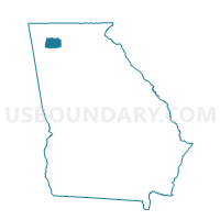
Outline

Summary
| Unique Area Identifier | 561904 |
| Name | 1291057 - RANGER Voting District |
| County | Gordon County |
| State | Georgia |
| Area (square miles) | 33.17 |
| Land Area (square miles) | 33.17 |
| Water Area (square miles) | 0.00 |
| % of Land Area | 100.00 |
| % of Water Area | 0.00 |
| Latitude of the Internal Point | 34.51439620 |
| Longtitude of the Internal Point | -84.71837530 |
Maps


Graphs
Select a template below for downloading or customizing gragh for 1291057 - RANGER Voting District, Gordon County, Georgia


Neighbors
Neighoring Voting District (by Name) Neighboring Voting District on the Map
- 12305 - LEACHES Voting District, Gilmer County, GA
- 1291056 - SONORAVILLE Voting District, Gordon County, GA
- 1291235 - OAKMAN Voting District, Gordon County, GA
- 129874 - FAIRMOUNT Voting District, Gordon County, GA
- 129973 - RED BUD Voting District, Gordon County, GA
- 2275 - LUDVILLE Voting District, Pickens County, GA
Top 10 Neighboring County Subdivision (by Population) Neighboring County Subdivision on the Map
- Carters Lake CCD, Gilmer County, GA (8,420)
- Fairmount CCD, Gordon County, GA (6,929)
- Redbud CCD, Gordon County, GA (5,933)
- Ludville CCD, Pickens County, GA (3,701)
Top 10 Neighboring Place (by Population) Neighboring Place on the Map
Top 10 Neighboring Unified School District (by Population) Neighboring Unified School District on the Map
- Gordon County School District, GA (39,599)
- Pickens County School District, GA (29,431)
- Gilmer County School District, GA (28,292)
Top 10 Neighboring State Legislative District Lower Chamber (by Population) Neighboring State Legislative District Lower Chamber on the Map
Top 10 Neighboring State Legislative District Upper Chamber (by Population) Neighboring State Legislative District Upper Chamber on the Map
Top 10 Neighboring 111th Congressional District (by Population) Neighboring 111th Congressional District on the Map
Top 10 Neighboring Census Tract (by Population) Neighboring Census Tract on the Map
- Census Tract 804, Gilmer County, GA (8,420)
- Census Tract 9709, Gordon County, GA (6,929)
- Census Tract 9701, Gordon County, GA (5,933)
- Census Tract 504, Pickens County, GA (3,701)