


063MO6 - MORROW 6 Voting District, Clayton County, Georgia
About
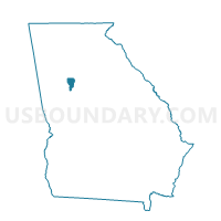
Outline

Summary
| Unique Area Identifier | 560733 |
| Name | 063MO6 - MORROW 6 Voting District |
| County | Clayton County |
| State | Georgia |
| Area (square miles) | 1.74 |
| Land Area (square miles) | 1.73 |
| Water Area (square miles) | 0.01 |
| % of Land Area | 99.68 |
| % of Water Area | 0.32 |
| Latitude of the Internal Point | 33.58216500 |
| Longtitude of the Internal Point | -84.28633650 |
Maps


Graphs
Select a template below for downloading or customizing gragh for 063MO6 - MORROW 6 Voting District, Clayton County, Georgia


Neighbors
Neighoring Voting District (by Name) Neighboring Voting District on the Map
- 063MO3 - MORROW 3 Voting District, Clayton County, GA
- 063MO4 - MORROW 4 Voting District, Clayton County, GA
- 063MO5 - MORROW 5 Voting District, Clayton County, GA
- 063MO7 - MORROW 7 Voting District, Clayton County, GA
- 063MO8 - MORROW 8 Voting District, Clayton County, GA
- 15154 - STOCKBRIDGE CENTER Voting District, Henry County, GA
- 15156 - LIGHTHOUSE Voting District, Henry County, GA
Top 10 Neighboring County Subdivision (by Population) Neighboring County Subdivision on the Map
Top 10 Neighboring Unified School District (by Population) Neighboring Unified School District on the Map
Top 10 Neighboring State Legislative District Lower Chamber (by Population) Neighboring State Legislative District Lower Chamber on the Map
Top 10 Neighboring State Legislative District Upper Chamber (by Population) Neighboring State Legislative District Upper Chamber on the Map
Top 10 Neighboring 111th Congressional District (by Population) Neighboring 111th Congressional District on the Map
Top 10 Neighboring Census Tract (by Population) Neighboring Census Tract on the Map
- Census Tract 404.11, Clayton County, GA (12,101)
- Census Tract 404.12, Clayton County, GA (7,227)
- Census Tract 404.13, Clayton County, GA (6,718)
- Census Tract 404.09, Clayton County, GA (5,716)
- Census Tract 701.06, Henry County, GA (5,669)