


Concho Voting District, Apache County, Arizona
About
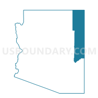
Outline

Summary
| Unique Area Identifier | 523619 |
| Name | Concho Voting District |
| County | Apache County |
| State | Arizona |
| Area (square miles) | 723.77 |
| Land Area (square miles) | 722.72 |
| Water Area (square miles) | 1.05 |
| % of Land Area | 99.85 |
| % of Water Area | 0.15 |
| Latitude of the Internal Point | 34.59288380 |
| Longtitude of the Internal Point | -109.67875520 |
Maps


Graphs
Select a template below for downloading or customizing gragh for Concho Voting District, Apache County, Arizona


Neighbors
Neighoring Voting District (by Name) Neighboring Voting District on the Map
- Cedar Hills Voting District, Navajo County, AZ
- Coronado Voting District, Apache County, AZ
- Holbrook 1 Voting District, Navajo County, AZ
- Puerco East Voting District, Apache County, AZ
- Puerco West Voting District, Apache County, AZ
- Round Valley Voting District, Apache County, AZ
- Show Low 4 Voting District, Navajo County, AZ
- St. Johns Voting District, Apache County, AZ
- Vernon Voting District, Apache County, AZ
- White Mnt Lake Voting District, Navajo County, AZ
- Woodruff Voting District, Navajo County, AZ
Top 10 Neighboring County Subdivision (by Population) Neighboring County Subdivision on the Map
- Snowflake CCD, Navajo County, AZ (46,905)
- Winslow-Holbrook CCD, Navajo County, AZ (18,068)
- St. Johns CCD, Apache County, AZ (8,235)
- Puerco CCD, Apache County, AZ (2,499)
Top 10 Neighboring Place (by Population) Neighboring Place on the Map
Top 10 Neighboring Elementary School District (by Population) Neighboring Elementary School District on the Map
Top 10 Neighboring Unified School District (by Population) Neighboring Unified School District on the Map
- Show Low Unified District, AZ (16,295)
- Snowflake Unified District, AZ (12,244)
- Holbrook Unified District, AZ (10,539)
- Round Valley Unified District, AZ (8,168)
- Sanders Unified District, AZ (5,899)
- St. Johns Unified District, AZ (4,198)
Top 10 Neighboring State Legislative District Lower Chamber (by Population) Neighboring State Legislative District Lower Chamber on the Map
Top 10 Neighboring State Legislative District Upper Chamber (by Population) Neighboring State Legislative District Upper Chamber on the Map
Top 10 Neighboring 111th Congressional District (by Population) Neighboring 111th Congressional District on the Map
Top 10 Neighboring Census Tract (by Population) Neighboring Census Tract on the Map
- Census Tract 9702, Apache County, AZ (4,990)
- Census Tract 9653, Navajo County, AZ (4,591)
- Census Tract 9638, Navajo County, AZ (4,513)
- Census Tract 9602, Navajo County, AZ (3,755)
- Census Tract 9634, Navajo County, AZ (3,262)
- Census Tract 9451, Apache County, AZ (2,221)
Top 10 Neighboring 5-Digit ZIP Code Tabulation Area (by Population) Neighboring 5-Digit ZIP Code Tabulation Area on the Map
- 85901, AZ (17,207)
- 85937, AZ (7,638)
- 86025, AZ (5,676)
- 85936, AZ (4,293)
- 85924, AZ (2,683)
- 86512, AZ (2,439)
- 86502, AZ (1,464)
- 85940, AZ (1,443)
- 85912, AZ (178)
- 86028, AZ (47)