


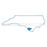
Columbus County Schools, North Carolina
About

** Data sources from census 2010 **
Maps


Graphs


Neighbors
Neighoring Unified School District (by Name) Neighboring Unified School District on the Map
- Bladen County Schools, NC
- Brunswick County Schools, NC
- Dillon School District 1, SC
- Horry County School District, SC
- Pender County Schools, NC
- Robeson County Schools, NC
- Whiteville City Schools, NC
Top 10 Neighboring County (by Population) Neighboring County on the Map
- Horry County, SC (269,291)
- Robeson County, NC (134,168)
- Brunswick County, NC (107,431)
- Columbus County, NC (58,098)
- Pender County, NC (52,217)
- Bladen County, NC (35,190)
- Dillon County, SC (32,062)
Top 10 Neighboring County Subdivision (by Population) Neighboring County Subdivision on the Map
- Little River CCD, Horry County, SC (33,652)
- Shallotte township, Brunswick County, NC (26,545)
- Lockwoods Folly township, Brunswick County, NC (23,248)
- Loris CCD, Horry County, SC (15,878)
- Northwest township, Brunswick County, NC (12,190)
- Whiteville township, Columbus County, NC (11,593)
- South Williams township, Columbus County, NC (7,023)
- Longs CCD, Horry County, SC (6,645)
- Wisharts township, Robeson County, NC (6,303)
- Chadbourn township, Columbus County, NC (6,219)
Top 10 Neighboring Place (by Population) Neighboring Place on the Map
- Tabor City town, NC (2,511)
- Chadbourn town, NC (1,856)
- Lake Waccamaw town, NC (1,480)
- Fair Bluff town, NC (951)
- Northwest city, NC (735)
- Bolton town, NC (691)
- Riegelwood CDP, NC (579)
- East Arcadia town, NC (487)
- Hallsboro CDP, NC (465)
- Sandyfield town, NC (447)
Top 10 Neighboring State Legislative District Lower Chamber (by Population) Neighboring State Legislative District Lower Chamber on the Map
- State House District 17, NC (94,557)
- State House District 16, NC (93,684)
- State House District 22, NC (83,941)
- State House District 46, NC (77,493)
- State House District 20, NC (70,972)
- State House District 48, NC (66,444)
- State House District 105, SC (55,771)
- State House District 104, SC (42,872)
- State House District 55, SC (34,048)
Top 10 Neighboring State Legislative District Upper Chamber (by Population) Neighboring State Legislative District Upper Chamber on the Map
- State Senate District 8, NC (217,746)
- State Senate District 19, NC (190,504)
- State Senate District 13, NC (181,120)
- State Senate District 28, SC (97,383)
Top 10 Neighboring 111th Congressional District (by Population) Neighboring 111th Congressional District on the Map
- Congressional District 1, SC (856,956)
- Congressional District 5, SC (767,773)
- Congressional District 7, NC (742,938)
Top 10 Neighboring Census Tract (by Population) Neighboring Census Tract on the Map
- Census Tract 9312, Columbus County, NC (7,803)
- Census Tract 9505, Bladen County, NC (6,707)
- Census Tract 9506, Bladen County, NC (6,453)
- Census Tract 202, Horry County, SC (5,849)
- Census Tract 9615, Robeson County, NC (5,841)
- Census Tract 9501, Bladen County, NC (5,693)
- Census Tract 9310, Columbus County, NC (5,687)
- Census Tract 9313, Columbus County, NC (5,653)
- Census Tract 206.02, Brunswick County, NC (5,147)
- Census Tract 9307, Columbus County, NC (4,815)
Top 10 Neighboring 5-Digit ZIP Code Tabulation Area (by Population) Neighboring 5-Digit ZIP Code Tabulation Area on the Map
- 28358, NC (38,738)
- 28451, NC (27,112)
- 28472, NC (19,658)
- 29569, SC (15,951)
- 29568, SC (12,224)
- 28463, NC (9,799)
- 28320, NC (9,229)
- 28467, NC (8,703)
- 28431, NC (7,102)
- 28433, NC (5,050)