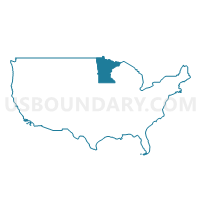
Minnesota
About
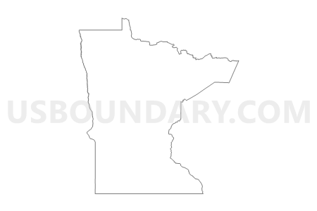
Outline
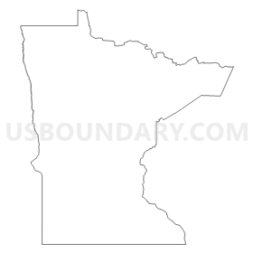
Summary
| Unique Area Identifier | 201780 |
| Name | Minnesota |
| Area (square miles) | 86,935.83 |
| Land Area (square miles) | 79,626.74 |
| Water Area (square miles) | 7,309.09 |
| % of Land Area | 91.59 |
| % of Water Area | 8.41 |
| Latitude of the Internal Point | 46.31613430 |
| Longtitude of the Internal Point | -94.19948010 |
| Total Population | 5,303,925 |
| Total Housing Units | 2,347,201 |
| Total Households | 2,087,227 |
| Median Age | 37.4 |
Maps
Graphs
Select a template below for downloading or customizing gragh for Minnesota



Neighbors
Neighoring State and Equivalent (by Name) Neighboring State and Equivalent on the Map
County in Minnesota (by Name) Neighboring County on the Map
- Aitkin County, MN
- Anoka County, MN
- Becker County, MN
- Beltrami County, MN
- Benton County, MN
- Big Stone County, MN
- Blue Earth County, MN
- Brown County, MN
- Carlton County, MN
- Carver County, MN
- Cass County, MN
- Chippewa County, MN
- Chisago County, MN
- Clay County, MN
- Clearwater County, MN
- Cook County, MN
- Cottonwood County, MN
- Crow Wing County, MN
- Dakota County, MN
- Dodge County, MN
- Douglas County, MN
- Faribault County, MN
- Fillmore County, MN
- Freeborn County, MN
- Goodhue County, MN
- Grant County, MN
- Hennepin County, MN
- Houston County, MN
- Hubbard County, MN
- Isanti County, MN
- Itasca County, MN
- Jackson County, MN
- Kanabec County, MN
- Kandiyohi County, MN
- Kittson County, MN
- Koochiching County, MN
- Lac qui Parle County, MN
- Lake County, MN
- Lake of the Woods County, MN
- Le Sueur County, MN
- Lincoln County, MN
- Lyon County, MN
- Mahnomen County, MN
- Marshall County, MN
- Martin County, MN
- McLeod County, MN
- Meeker County, MN
- Mille Lacs County, MN
- Morrison County, MN
- Mower County, MN
- Murray County, MN
- Nicollet County, MN
- Nobles County, MN
- Norman County, MN
- Olmsted County, MN
- Otter Tail County, MN
- Pennington County, MN
- Pine County, MN
- Pipestone County, MN
- Polk County, MN
- Pope County, MN
- Ramsey County, MN
- Red Lake County, MN
- Redwood County, MN
- Renville County, MN
- Rice County, MN
- Rock County, MN
- Roseau County, MN
- Scott County, MN
- Sherburne County, MN
- Sibley County, MN
- St. Louis County, MN
- Stearns County, MN
- Steele County, MN
- Stevens County, MN
- Swift County, MN
- Todd County, MN
- Traverse County, MN
- Wabasha County, MN
- Wadena County, MN
- Waseca County, MN
- Washington County, MN
- Watonwan County, MN
- Wilkin County, MN
- Winona County, MN
- Wright County, MN
- Yellow Medicine County, MN
Top 10 County Subdivision in Minnesota (by Population) Neighboring County Subdivision on the Map
- Minneapolis city, Hennepin County, MN (382,578)
- St. Paul city, Ramsey County, MN (285,068)
- Rochester city, Olmsted County, MN (106,769)
- Duluth city, St. Louis County, MN (86,265)
- Bloomington city, Hennepin County, MN (82,893)
- Brooklyn Park city, Hennepin County, MN (75,781)
- Plymouth city, Hennepin County, MN (70,576)
- Eagan city, Dakota County, MN (64,206)
- Woodbury city, Washington County, MN (61,961)
- Maple Grove city, Hennepin County, MN (61,567)
Top 10 Place in Minnesota (by Population) Neighboring Place on the Map
- Minneapolis city, MN (382,578)
- St. Paul city, MN (285,068)
- Rochester city, MN (106,769)
- Duluth city, MN (86,265)
- Bloomington city, MN (82,893)
- Brooklyn Park city, MN (75,781)
- Plymouth city, MN (70,576)
- St. Cloud city, MN (65,842)
- Eagan city, MN (64,206)
- Woodbury city, MN (61,961)
Top 10 Unified School District in Minnesota (by Population) Neighboring Unified School District on the Map
- Minneapolis Public School District, MN (382,583)
- St. Paul Public School District, MN (285,068)
- Anoka-Hennepin Public School District, MN (226,412)
- Rosemount-Apple Valley-Eagan School District, MN (143,932)
- Osseo Public School District, MN (135,140)
- Rochester Public School District, MN (119,931)
- Robbinsdale Public School District, MN (98,989)
- St. Cloud Public School District, MN (96,237)
- Duluth Public School District, MN (95,252)
- South Washington County School District, MN (92,998)
Top 10 State Legislative District Lower Chamber in Minnesota (by Population) Neighboring State Legislative District Lower Chamber on the Map
- State House District 35A, MN (59,872)
- State House District 19B, MN (59,068)
- State House District 32A, MN (55,517)
- State House District 16B, MN (52,029)
- State House District 36B, MN (50,199)
- State House District 56B, MN (49,803)
- State House District 51A, MN (49,630)
- State House District 17B, MN (49,009)
- State House District 35B, MN (48,692)
- State House District 29A, MN (48,197)
Top 10 State Legislative District Upper Chamber in Minnesota (by Population) Neighboring State Legislative District Upper Chamber on the Map
- State Senate District 35, MN (108,564)
- State Senate District 19, MN (106,452)
- State Senate District 36, MN (96,657)
- State Senate District 16, MN (95,820)
- State Senate District 17, MN (94,415)
- State Senate District 34, MN (94,255)
- State Senate District 56, MN (91,226)
- State Senate District 32, MN (90,959)
- State Senate District 52, MN (90,197)
- State Senate District 29, MN (86,779)
Top 10 111th Congressional District in Minnesota (by Population) Neighboring 111th Congressional District on the Map
- Congressional District 6, MN (759,478)
- Congressional District 2, MN (732,515)
- Congressional District 8, MN (660,342)
- Congressional District 3, MN (650,185)
- Congressional District 1, MN (644,787)
- Congressional District 7, MN (625,512)
- Congressional District 5, MN (616,482)
- Congressional District 4, MN (614,624)
Top 10 Census Tract in Minnesota (by Population) Neighboring Census Tract on the Map
- Census Tract 803.02, Scott County, MN (14,633)
- Census Tract 1008.02, Wright County, MN (13,797)
- Census Tract 1008.01, Wright County, MN (12,818)
- Census Tract 1001, Wright County, MN (12,767)
- Census Tract 710.18, Washington County, MN (12,597)
- Census Tract 267.15, Hennepin County, MN (12,453)
- Census Tract 268.20, Hennepin County, MN (12,114)
- Census Tract 269.09, Hennepin County, MN (11,806)
- Census Tract 14.02, Olmsted County, MN (11,535)
- Census Tract 301.01, Sherburne County, MN (11,300)
Top 10 5-Digit ZIP Code Tabulation Area in Minnesota (by Population) Neighboring 5-Digit ZIP Code Tabulation Area on the Map
- 55106, MN (52,730)
- 55901, MN (51,917)
- 55124, MN (49,084)
- 55044, MN (47,218)
- 55303, MN (46,352)
- 56001, MN (46,327)
- 55304, MN (45,967)
- 55337, MN (44,356)
- 55125, MN (43,281)
- 55112, MN (43,250)
Data
Demographic, Population, Households, and Housing Units
** Data sources from census 2010 **
Show Data on Map
Download Full List as CSV
Download Quick Sheet as CSV
| Subject | This Area | National |
|---|---|---|
| POPULATION | ||
| Total Population Map | 5,303,925 | 308,745,538 |
| POPULATION, HISPANIC OR LATINO ORIGIN | ||
| Not Hispanic or Latino Map | 5,053,667 | 258,267,944 |
| Hispanic or Latino Map | 250,258 | 50,477,594 |
| POPULATION, RACE | ||
| White alone Map | 4,524,062 | 223,553,265 |
| Black or African American alone Map | 274,412 | 38,929,319 |
| American Indian and Alaska Native alone Map | 60,916 | 2,932,248 |
| Asian alone Map | 214,234 | 14,674,252 |
| Native Hawaiian and Other Pacific Islander alone Map | 2,156 | 540,013 |
| Some Other Race alone Map | 103,000 | 19,107,368 |
| Two or More Races Map | 125,145 | 9,009,073 |
| POPULATION, SEX | ||
| Male Map | 2,632,132 | 151,781,326 |
| Female Map | 2,671,793 | 156,964,212 |
| POPULATION, AGE (18 YEARS) | ||
| 18 years and over Map | 4,019,862 | 234,564,071 |
| Under 18 years | 1,284,063 | 74,181,467 |
| POPULATION, AGE | ||
| Under 5 years | 355,504 | 20,201,362 |
| 5 to 9 years | 355,536 | 20,348,657 |
| 10 to 14 years | 352,342 | 20,677,194 |
| 15 to 17 years | 220,681 | 12,954,254 |
| 18 and 19 years | 147,148 | 9,086,089 |
| 20 years | 72,732 | 4,519,129 |
| 21 years | 70,594 | 4,354,294 |
| 22 to 24 years | 212,325 | 12,712,576 |
| 25 to 29 years | 372,686 | 21,101,849 |
| 30 to 34 years | 342,900 | 19,962,099 |
| 35 to 39 years | 328,190 | 20,179,642 |
| 40 to 44 years | 352,904 | 20,890,964 |
| 45 to 49 years | 406,203 | 22,708,591 |
| 50 to 54 years | 401,695 | 22,298,125 |
| 55 to 59 years | 349,589 | 19,664,805 |
| 60 and 61 years | 120,761 | 7,113,727 |
| 62 to 64 years | 159,014 | 9,704,197 |
| 65 and 66 years | 86,158 | 5,319,902 |
| 67 to 69 years | 116,412 | 7,115,361 |
| 70 to 74 years | 151,857 | 9,278,166 |
| 75 to 79 years | 122,114 | 7,317,795 |
| 80 to 84 years | 99,916 | 5,743,327 |
| 85 years and over | 106,664 | 5,493,433 |
| MEDIAN AGE BY SEX | ||
| Both sexes Map | 37.40 | 37.20 |
| Male Map | 36.30 | 35.80 |
| Female Map | 38.40 | 38.50 |
| HOUSEHOLDS | ||
| Total Households Map | 2,087,227 | 116,716,292 |
| HOUSEHOLDS, HOUSEHOLD TYPE | ||
| Family households: Map | 1,349,015 | 77,538,296 |
| Husband-wife family Map | 1,060,509 | 56,510,377 |
| Other family: Map | 288,506 | 21,027,919 |
| Male householder, no wife present Map | 89,707 | 5,777,570 |
| Female householder, no husband present Map | 198,799 | 15,250,349 |
| Nonfamily households: Map | 738,212 | 39,177,996 |
| Householder living alone Map | 584,008 | 31,204,909 |
| Householder not living alone Map | 154,204 | 7,973,087 |
| HOUSEHOLDS, HISPANIC OR LATINO ORIGIN OF HOUSEHOLDER | ||
| Not Hispanic or Latino householder: Map | 2,027,489 | 103,254,926 |
| Hispanic or Latino householder: Map | 59,738 | 13,461,366 |
| HOUSEHOLDS, RACE OF HOUSEHOLDER | ||
| Householder who is White alone | 1,870,205 | 89,754,352 |
| Householder who is Black or African American alone | 90,187 | 14,129,983 |
| Householder who is American Indian and Alaska Native alone | 19,078 | 939,707 |
| Householder who is Asian alone | 57,475 | 4,632,164 |
| Householder who is Native Hawaiian and Other Pacific Islander alone | 603 | 143,932 |
| Householder who is Some Other Race alone | 24,853 | 4,916,427 |
| Householder who is Two or More Races | 24,826 | 2,199,727 |
| HOUSEHOLDS, HOUSEHOLD TYPE BY HOUSEHOLD SIZE | ||
| Family households: Map | 1,349,015 | 77,538,296 |
| 2-person household Map | 602,770 | 31,882,616 |
| 3-person household Map | 289,028 | 17,765,829 |
| 4-person household Map | 265,265 | 15,214,075 |
| 5-person household Map | 119,947 | 7,411,997 |
| 6-person household Map | 43,372 | 3,026,278 |
| 7-or-more-person household Map | 28,633 | 2,237,501 |
| Nonfamily households: Map | 738,212 | 39,177,996 |
| 1-person household Map | 584,008 | 31,204,909 |
| 2-person household Map | 121,616 | 6,360,012 |
| 3-person household Map | 18,766 | 992,156 |
| 4-person household Map | 9,356 | 411,171 |
| 5-person household Map | 3,055 | 126,634 |
| 6-person household Map | 886 | 48,421 |
| 7-or-more-person household Map | 525 | 34,693 |
| HOUSING UNITS | ||
| Total Housing Units Map | 2,347,201 | 131,704,730 |
| HOUSING UNITS, OCCUPANCY STATUS | ||
| Occupied Map | 2,087,227 | 116,716,292 |
| Vacant Map | 259,974 | 14,988,438 |
| HOUSING UNITS, OCCUPIED, TENURE | ||
| Owned with a mortgage or a loan Map | 1,109,405 | 52,979,430 |
| Owned free and clear Map | 414,454 | 23,006,644 |
| Renter occupied Map | 563,368 | 40,730,218 |
| HOUSING UNITS, VACANT, VACANCY STATUS | ||
| For rent Map | 48,091 | 4,137,567 |
| Rented, not occupied Map | 3,198 | 206,825 |
| For sale only Map | 30,726 | 1,896,796 |
| Sold, not occupied Map | 6,232 | 421,032 |
| For seasonal, recreational, or occasional use Map | 130,471 | 4,649,298 |
| For migrant workers Map | 334 | 24,161 |
| Other vacant Map | 40,922 | 3,652,759 |
| HOUSING UNITS, OCCUPIED, AVERAGE HOUSEHOLD SIZE BY TENURE | ||
| Total: Map | 2.48 | 2.58 |
| Owner occupied Map | 2.59 | 2.65 |
| Renter occupied Map | 2.16 | 2.44 |
| HOUSING UNITS, OCCUPIED, TENURE BY RACE OF HOUSEHOLDER | ||
| Owner occupied: Map | 1,523,859 | 75,986,074 |
| Householder who is White alone Map | 1,437,173 | 63,446,275 |
| Householder who is Black or African American alone Map | 22,968 | 6,261,464 |
| Householder who is American Indian and Alaska Native alone Map | 9,155 | 509,588 |
| Householder who is Asian alone Map | 32,562 | 2,688,861 |
| Householder who is Native Hawaiian and Other Pacific Islander alone Map | 308 | 61,911 |
| Householder who is Some Other Race alone Map | 9,816 | 1,975,817 |
| Householder who is Two or More Races Map | 11,877 | 1,042,158 |
| Renter occupied: Map | 563,368 | 40,730,218 |
| Householder who is White alone Map | 433,032 | 26,308,077 |
| Householder who is Black or African American alone Map | 67,219 | 7,868,519 |
| Householder who is American Indian and Alaska Native alone Map | 9,923 | 430,119 |
| Householder who is Asian alone Map | 24,913 | 1,943,303 |
| Householder who is Native Hawaiian and Other Pacific Islander alone Map | 295 | 82,021 |
| Householder who is Some Other Race alone Map | 15,037 | 2,940,610 |
| Householder who is Two or More Races Map | 12,949 | 1,157,569 |
| HOUSING UNITS, OCCUPIED, TENURE BY HISPANIC OR LATINO ORIGIN OF HOUSEHOLDER | ||
| Owner occupied: Map | 1,523,859 | 75,986,074 |
| Not Hispanic or Latino householder Map | 1,497,368 | 69,617,625 |
| Hispanic or Latino householder Map | 26,491 | 6,368,449 |
| Renter occupied: Map | 563,368 | 40,730,218 |
| Not Hispanic or Latino householder Map | 530,121 | 33,637,301 |
| Hispanic or Latino householder Map | 33,247 | 7,092,917 |
| HOUSING UNITS, OCCUPIED, TENURE BY HOUSEHOLD SIZE | ||
| Owner occupied: Map | 1,523,859 | 75,986,074 |
| 1-person household Map | 329,955 | 16,453,569 |
| 2-person household Map | 581,481 | 27,618,605 |
| 3-person household Map | 236,596 | 12,517,563 |
| 4-person household Map | 224,564 | 10,998,793 |
| 5-person household Map | 98,018 | 5,057,765 |
| 6-person household Map | 33,229 | 1,965,796 |
| 7-or-more-person household Map | 20,016 | 1,373,983 |
| Renter occupied: Map | 563,368 | 40,730,218 |
| 1-person household Map | 254,053 | 14,751,340 |
| 2-person household Map | 142,905 | 10,624,023 |
| 3-person household Map | 71,198 | 6,240,422 |
| 4-person household Map | 50,057 | 4,626,453 |
| 5-person household Map | 24,984 | 2,480,866 |
| 6-person household Map | 11,029 | 1,108,903 |
| 7-or-more-person household Map | 9,142 | 898,211 |
Loading...


