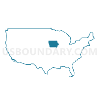
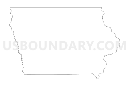
Iowa
About
Outline

Summary
| Unique Area Identifier | 201778 |
| Name | Iowa |
| Area (square miles) | 56,272.80 |
| Land Area (square miles) | 55,857.13 |
| Water Area (square miles) | 415.68 |
| % of Land Area | 99.26 |
| % of Water Area | 0.74 |
| Latitude of the Internal Point | 42.07002430 |
| Longtitude of the Internal Point | -93.49334730 |
| Total Population | 3,046,355 |
| Total Housing Units | 1,336,417 |
| Total Households | 1,221,576 |
| Median Age | 38.1 |
Maps
Graphs
Select a template below for downloading or customizing gragh for Iowa


Neighbors
Neighoring State and Equivalent (by Name) Neighboring State and Equivalent on the Map
County in Iowa (by Name) Neighboring County on the Map
- Adair County, IA
- Adams County, IA
- Allamakee County, IA
- Appanoose County, IA
- Audubon County, IA
- Benton County, IA
- Black Hawk County, IA
- Boone County, IA
- Bremer County, IA
- Buchanan County, IA
- Buena Vista County, IA
- Butler County, IA
- Calhoun County, IA
- Carroll County, IA
- Cass County, IA
- Cedar County, IA
- Cerro Gordo County, IA
- Cherokee County, IA
- Chickasaw County, IA
- Clarke County, IA
- Clay County, IA
- Clayton County, IA
- Clinton County, IA
- Crawford County, IA
- Dallas County, IA
- Davis County, IA
- Decatur County, IA
- Delaware County, IA
- Des Moines County, IA
- Dickinson County, IA
- Dubuque County, IA
- Emmet County, IA
- Fayette County, IA
- Floyd County, IA
- Franklin County, IA
- Fremont County, IA
- Greene County, IA
- Grundy County, IA
- Guthrie County, IA
- Hamilton County, IA
- Hancock County, IA
- Hardin County, IA
- Harrison County, IA
- Henry County, IA
- Howard County, IA
- Humboldt County, IA
- Ida County, IA
- Iowa County, IA
- Jackson County, IA
- Jasper County, IA
- Jefferson County, IA
- Johnson County, IA
- Jones County, IA
- Keokuk County, IA
- Kossuth County, IA
- Lee County, IA
- Linn County, IA
- Louisa County, IA
- Lucas County, IA
- Lyon County, IA
- Madison County, IA
- Mahaska County, IA
- Marion County, IA
- Marshall County, IA
- Mills County, IA
- Mitchell County, IA
- Monona County, IA
- Monroe County, IA
- Montgomery County, IA
- Muscatine County, IA
- O'Brien County, IA
- Osceola County, IA
- Page County, IA
- Palo Alto County, IA
- Plymouth County, IA
- Pocahontas County, IA
- Polk County, IA
- Pottawattamie County, IA
- Poweshiek County, IA
- Ringgold County, IA
- Sac County, IA
- Scott County, IA
- Shelby County, IA
- Sioux County, IA
- Story County, IA
- Tama County, IA
- Taylor County, IA
- Union County, IA
- Van Buren County, IA
- Wapello County, IA
- Warren County, IA
- Washington County, IA
- Wayne County, IA
- Webster County, IA
- Winnebago County, IA
- Winneshiek County, IA
- Woodbury County, IA
- Worth County, IA
- Wright County, IA
Top 10 County Subdivision in Iowa (by Population) Neighboring County Subdivision on the Map
- Cedar Rapids city, Linn County, IA (126,326)
- Davenport city, Scott County, IA (99,685)
- Des Moines township, Polk County, IA (98,631)
- Sioux City city, Woodbury County, IA (82,678)
- Waterloo city, Black Hawk County, IA (68,406)
- Iowa City city, Johnson County, IA (67,862)
- Walnut township, Polk County, IA (66,174)
- Lee township, Polk County, IA (63,026)
- Dubuque city, Dubuque County, IA (57,637)
- Webster township, Polk County, IA (54,365)
Top 10 Place in Iowa (by Population) Neighboring Place on the Map
- Des Moines city, IA (203,433)
- Cedar Rapids city, IA (126,326)
- Davenport city, IA (99,685)
- Sioux City city, IA (82,684)
- Waterloo city, IA (68,406)
- Iowa City city, IA (67,862)
- Council Bluffs city, IA (62,230)
- Ames city, IA (58,965)
- Dubuque city, IA (57,637)
- West Des Moines city, IA (56,609)
Top 10 Unified School District in Iowa (by Population) Neighboring Unified School District on the Map
- Des Moines Independent Community School District, IA (203,307)
- Cedar Rapids Community School District, IA (119,310)
- Davenport Community School District, IA (106,742)
- Iowa City Community School District, IA (105,355)
- Sioux City Community School District, IA (83,145)
- Waterloo Community School District, IA (78,321)
- Dubuque Community School District, IA (75,725)
- West Des Moines Community School District, IA (64,104)
- Council Bluffs Community School District, IA (59,804)
- Ames Community School District, IA (56,434)
Top 10 State Legislative District Lower Chamber in Iowa (by Population) Neighboring State Legislative District Lower Chamber on the Map
- State House District 47, IA (54,425)
- State House District 69, IA (51,009)
- State House District 30, IA (42,788)
- State House District 70, IA (41,393)
- State House District 67, IA (37,653)
- State House District 36, IA (37,187)
- State House District 42, IA (36,928)
- State House District 45, IA (35,688)
- State House District 35, IA (35,173)
- State House District 63, IA (34,062)
Top 10 State Legislative District Upper Chamber in Iowa (by Population) Neighboring State Legislative District Upper Chamber on the Map
- State Senate District 35, IA (92,402)
- State Senate District 24, IA (83,683)
- State Senate District 15, IA (76,152)
- State Senate District 18, IA (72,360)
- State Senate District 34, IA (69,287)
- State Senate District 23, IA (67,311)
- State Senate District 37, IA (66,229)
- State Senate District 21, IA (65,772)
- State Senate District 16, IA (62,654)
- State Senate District 10, IA (62,481)
Top 10 111th Congressional District in Iowa (by Population) Neighboring 111th Congressional District on the Map
- Congressional District 3, IA (642,116)
- Congressional District 2, IA (620,856)
- Congressional District 4, IA (609,487)
- Congressional District 1, IA (596,443)
- Congressional District 5, IA (577,453)
Top 10 Census Tract in Iowa (by Population) Neighboring Census Tract on the Map
- Census Tract 102.03, Polk County, IA (20,422)
- Census Tract 113, Polk County, IA (13,584)
- Census Tract 1, Linn County, IA (12,535)
- Census Tract 103.02, Johnson County, IA (11,326)
- Census Tract 1, Story County, IA (10,778)
- Census Tract 103.01, Johnson County, IA (10,218)
- Census Tract 26.03, Black Hawk County, IA (10,029)
- Census Tract 13.01, Story County, IA (9,427)
- Census Tract 30.01, Linn County, IA (9,226)
- Census Tract 3.01, Johnson County, IA (9,143)
Top 10 5-Digit ZIP Code Tabulation Area in Iowa (by Population) Neighboring 5-Digit ZIP Code Tabulation Area on the Map
- 52001, IA (43,173)
- 50613, IA (42,031)
- 52402, IA (40,149)
- 52404, IA (37,796)
- 52302, IA (36,980)
- 51503, IA (36,376)
- 50317, IA (36,207)
- 50315, IA (35,853)
- 51501, IA (35,406)
- 52722, IA (34,754)
Data
Demographic, Population, Households, and Housing Units
** Data sources from census 2010 **
Show Data on Map
Download Full List as CSV
Download Quick Sheet as CSV
| Subject | This Area | National |
|---|---|---|
| POPULATION | ||
| Total Population Map | 3,046,355 | 308,745,538 |
| POPULATION, HISPANIC OR LATINO ORIGIN | ||
| Not Hispanic or Latino Map | 2,894,811 | 258,267,944 |
| Hispanic or Latino Map | 151,544 | 50,477,594 |
| POPULATION, RACE | ||
| White alone Map | 2,781,561 | 223,553,265 |
| Black or African American alone Map | 89,148 | 38,929,319 |
| American Indian and Alaska Native alone Map | 11,084 | 2,932,248 |
| Asian alone Map | 53,094 | 14,674,252 |
| Native Hawaiian and Other Pacific Islander alone Map | 2,003 | 540,013 |
| Some Other Race alone Map | 56,132 | 19,107,368 |
| Two or More Races Map | 53,333 | 9,009,073 |
| POPULATION, SEX | ||
| Male Map | 1,508,319 | 151,781,326 |
| Female Map | 1,538,036 | 156,964,212 |
| POPULATION, AGE (18 YEARS) | ||
| 18 years and over Map | 2,318,362 | 234,564,071 |
| Under 18 years | 727,993 | 74,181,467 |
| POPULATION, AGE | ||
| Under 5 years | 202,123 | 20,201,362 |
| 5 to 9 years | 200,646 | 20,348,657 |
| 10 to 14 years | 200,904 | 20,677,194 |
| 15 to 17 years | 124,320 | 12,954,254 |
| 18 and 19 years | 92,517 | 9,086,089 |
| 20 years | 47,227 | 4,519,129 |
| 21 years | 44,695 | 4,354,294 |
| 22 to 24 years | 121,428 | 12,712,576 |
| 25 to 29 years | 197,843 | 21,101,849 |
| 30 to 34 years | 184,740 | 19,962,099 |
| 35 to 39 years | 177,148 | 20,179,642 |
| 40 to 44 years | 187,400 | 20,890,964 |
| 45 to 49 years | 216,482 | 22,708,591 |
| 50 to 54 years | 223,244 | 22,298,125 |
| 55 to 59 years | 204,393 | 19,664,805 |
| 60 and 61 years | 72,152 | 7,113,727 |
| 62 to 64 years | 96,205 | 9,704,197 |
| 65 and 66 years | 52,304 | 5,319,902 |
| 67 to 69 years | 72,061 | 7,115,361 |
| 70 to 74 years | 100,291 | 9,278,166 |
| 75 to 79 years | 83,387 | 7,317,795 |
| 80 to 84 years | 70,187 | 5,743,327 |
| 85 years and over | 74,658 | 5,493,433 |
| MEDIAN AGE BY SEX | ||
| Both sexes Map | 38.10 | 37.20 |
| Male Map | 36.60 | 35.80 |
| Female Map | 39.50 | 38.50 |
| HOUSEHOLDS | ||
| Total Households Map | 1,221,576 | 116,716,292 |
| HOUSEHOLDS, HOUSEHOLD TYPE | ||
| Family households: Map | 790,034 | 77,538,296 |
| Husband-wife family Map | 625,173 | 56,510,377 |
| Other family: Map | 164,861 | 21,027,919 |
| Male householder, no wife present Map | 51,105 | 5,777,570 |
| Female householder, no husband present Map | 113,756 | 15,250,349 |
| Nonfamily households: Map | 431,542 | 39,177,996 |
| Householder living alone Map | 347,479 | 31,204,909 |
| Householder not living alone Map | 84,063 | 7,973,087 |
| HOUSEHOLDS, HISPANIC OR LATINO ORIGIN OF HOUSEHOLDER | ||
| Not Hispanic or Latino householder: Map | 1,184,389 | 103,254,926 |
| Hispanic or Latino householder: Map | 37,187 | 13,461,366 |
| HOUSEHOLDS, RACE OF HOUSEHOLDER | ||
| Householder who is White alone | 1,147,691 | 89,754,352 |
| Householder who is Black or African American alone | 29,305 | 14,129,983 |
| Householder who is American Indian and Alaska Native alone | 3,414 | 939,707 |
| Householder who is Asian alone | 15,860 | 4,632,164 |
| Householder who is Native Hawaiian and Other Pacific Islander alone | 476 | 143,932 |
| Householder who is Some Other Race alone | 14,481 | 4,916,427 |
| Householder who is Two or More Races | 10,349 | 2,199,727 |
| HOUSEHOLDS, HOUSEHOLD TYPE BY HOUSEHOLD SIZE | ||
| Family households: Map | 790,034 | 77,538,296 |
| 2-person household Map | 379,328 | 31,882,616 |
| 3-person household Map | 162,734 | 17,765,829 |
| 4-person household Map | 142,197 | 15,214,075 |
| 5-person household Map | 68,261 | 7,411,997 |
| 6-person household Map | 24,263 | 3,026,278 |
| 7-or-more-person household Map | 13,251 | 2,237,501 |
| Nonfamily households: Map | 431,542 | 39,177,996 |
| 1-person household Map | 347,479 | 31,204,909 |
| 2-person household Map | 66,548 | 6,360,012 |
| 3-person household Map | 10,678 | 992,156 |
| 4-person household Map | 5,088 | 411,171 |
| 5-person household Map | 1,269 | 126,634 |
| 6-person household Map | 316 | 48,421 |
| 7-or-more-person household Map | 164 | 34,693 |
| HOUSING UNITS | ||
| Total Housing Units Map | 1,336,417 | 131,704,730 |
| HOUSING UNITS, OCCUPANCY STATUS | ||
| Occupied Map | 1,221,576 | 116,716,292 |
| Vacant Map | 114,841 | 14,988,438 |
| HOUSING UNITS, OCCUPIED, TENURE | ||
| Owned with a mortgage or a loan Map | 573,988 | 52,979,430 |
| Owned free and clear Map | 306,647 | 23,006,644 |
| Renter occupied Map | 340,941 | 40,730,218 |
| HOUSING UNITS, VACANT, VACANCY STATUS | ||
| For rent Map | 31,812 | 4,137,567 |
| Rented, not occupied Map | 1,803 | 206,825 |
| For sale only Map | 18,405 | 1,896,796 |
| Sold, not occupied Map | 5,555 | 421,032 |
| For seasonal, recreational, or occasional use Map | 21,020 | 4,649,298 |
| For migrant workers Map | 87 | 24,161 |
| Other vacant Map | 36,159 | 3,652,759 |
| HOUSING UNITS, OCCUPIED, AVERAGE HOUSEHOLD SIZE BY TENURE | ||
| Total: Map | 2.41 | 2.58 |
| Owner occupied Map | 2.52 | 2.65 |
| Renter occupied Map | 2.14 | 2.44 |
| HOUSING UNITS, OCCUPIED, TENURE BY RACE OF HOUSEHOLDER | ||
| Owner occupied: Map | 880,635 | 75,986,074 |
| Householder who is White alone Map | 849,767 | 63,446,275 |
| Householder who is Black or African American alone Map | 9,110 | 6,261,464 |
| Householder who is American Indian and Alaska Native alone Map | 1,585 | 509,588 |
| Householder who is Asian alone Map | 8,306 | 2,688,861 |
| Householder who is Native Hawaiian and Other Pacific Islander alone Map | 160 | 61,911 |
| Householder who is Some Other Race alone Map | 6,837 | 1,975,817 |
| Householder who is Two or More Races Map | 4,870 | 1,042,158 |
| Renter occupied: Map | 340,941 | 40,730,218 |
| Householder who is White alone Map | 297,924 | 26,308,077 |
| Householder who is Black or African American alone Map | 20,195 | 7,868,519 |
| Householder who is American Indian and Alaska Native alone Map | 1,829 | 430,119 |
| Householder who is Asian alone Map | 7,554 | 1,943,303 |
| Householder who is Native Hawaiian and Other Pacific Islander alone Map | 316 | 82,021 |
| Householder who is Some Other Race alone Map | 7,644 | 2,940,610 |
| Householder who is Two or More Races Map | 5,479 | 1,157,569 |
| HOUSING UNITS, OCCUPIED, TENURE BY HISPANIC OR LATINO ORIGIN OF HOUSEHOLDER | ||
| Owner occupied: Map | 880,635 | 75,986,074 |
| Not Hispanic or Latino householder Map | 861,741 | 69,617,625 |
| Hispanic or Latino householder Map | 18,894 | 6,368,449 |
| Renter occupied: Map | 340,941 | 40,730,218 |
| Not Hispanic or Latino householder Map | 322,648 | 33,637,301 |
| Hispanic or Latino householder Map | 18,293 | 7,092,917 |
| HOUSING UNITS, OCCUPIED, TENURE BY HOUSEHOLD SIZE | ||
| Owner occupied: Map | 880,635 | 75,986,074 |
| 1-person household Map | 197,923 | 16,453,569 |
| 2-person household Map | 355,975 | 27,618,605 |
| 3-person household Map | 127,879 | 12,517,563 |
| 4-person household Map | 115,932 | 10,998,793 |
| 5-person household Map | 54,480 | 5,057,765 |
| 6-person household Map | 18,720 | 1,965,796 |
| 7-or-more-person household Map | 9,726 | 1,373,983 |
| Renter occupied: Map | 340,941 | 40,730,218 |
| 1-person household Map | 149,556 | 14,751,340 |
| 2-person household Map | 89,901 | 10,624,023 |
| 3-person household Map | 45,533 | 6,240,422 |
| 4-person household Map | 31,353 | 4,626,453 |
| 5-person household Map | 15,050 | 2,480,866 |
| 6-person household Map | 5,859 | 1,108,903 |
| 7-or-more-person household Map | 3,689 | 898,211 |
Loading...


