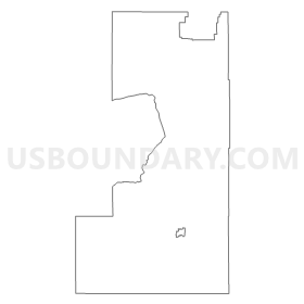
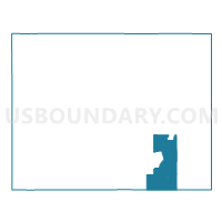
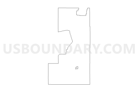
State Senate District 10, Wyoming
About
** Data sources from census 2010 **
Maps
Graphs
Neighbors
Neighoring State Legislative District Upper Chamber (by Name) Neighboring State Legislative District Upper Chamber on the Map
- State Senate District 11, WY
- State Senate District 15, CO
- State Senate District 2, WY
- State Senate District 4, WY
- State Senate District 5, WY
- State Senate District 8, CO
- State Senate District 8, WY
- State Senate District 9, WY
Top 10 Neighboring County (by Population) Neighboring County on the Map
- Larimer County, CO (299,630)
- Laramie County, WY (91,738)
- Albany County, WY (36,299)
- Carbon County, WY (15,885)
- Converse County, WY (13,833)
- Platte County, WY (8,667)
- Jackson County, CO (1,394)
Top 10 Neighboring County Subdivision (by Population) Neighboring County Subdivision on the Map
- Laramie CCD, Albany County, WY (34,157)
- Timnath-Wellington CCD, Larimer County, CO (18,311)
- Douglas CCD, Converse County, WY (9,537)
- Cheyenne West CCD, Laramie County, WY (7,254)
- Wheatland CCD, Platte County, WY (6,053)
- Livermore CCD, Larimer County, CO (5,069)
- Glenrock CCD, Converse County, WY (4,296)
- Saratoga CCD, Carbon County, WY (3,181)
- Hanna CCD, Carbon County, WY (1,639)
- South Albany CCD, Albany County, WY (1,528)
Top 10 Neighboring Place (by Population) Neighboring Place on the Map
- Laramie city, WY (30,816)
- Centennial CDP, WY (270)
- Woods Landing-Jelm CDP, WY (97)
- Albany CDP, WY (55)
- Fox Park CDP, WY (22)
Top 10 Neighboring Unified School District (by Population) Neighboring Unified School District on the Map
- Poudre School District R-1, CO (184,648)
- Laramie County School District 1, WY (86,198)
- Albany County School District 1, WY (36,299)
- Converse County School District 1, WY (9,557)
- Platte County School District 1, WY (7,251)
- Carbon County School District 2, WY (4,796)
- Converse County School District 2, WY (4,276)
- North Park School District R-1, CO (1,394)
Top 10 Neighboring State Legislative District Lower Chamber (by Population) Neighboring State Legislative District Lower Chamber on the Map
- State House District 49, CO (83,740)
- State House District 57, CO (78,537)
- State House District 7, WY (10,209)
- State House District 12, WY (9,810)
- State House District 6, WY (9,518)
- State House District 45, WY (9,417)
- State House District 46, WY (9,230)
- State House District 14, WY (9,049)
- State House District 3, WY (8,892)
- State House District 13, WY (8,308)
Top 10 Neighboring 111th Congressional District (by Population) Neighboring 111th Congressional District on the Map
- Congressional District 4, CO (725,041)
- Congressional District 3, CO (706,186)
- Congressional District (at Large), WY (563,626)
Top 10 Neighboring Census Tract (by Population) Neighboring Census Tract on the Map
- Census Tract 9631, Albany County, WY (7,020)
- Census Tract 9594, Platte County, WY (6,575)
- Census Tract 9637, Albany County, WY (5,226)
- Census Tract 9636, Albany County, WY (4,617)
- Census Tract 19.02, Laramie County, WY (4,182)
- Census Tract 9634, Albany County, WY (3,498)
- Census Tract 9627, Albany County, WY (3,368)
- Census Tract 9628, Albany County, WY (3,285)
- Census Tract 9566, Converse County, WY (3,194)
- Census Tract 9680, Carbon County, WY (3,181)
Top 10 Neighboring 5-Digit ZIP Code Tabulation Area (by Population) Neighboring 5-Digit ZIP Code Tabulation Area on the Map
- 82009, WY (31,703)
- 82070, WY (19,766)
- 82072, WY (15,533)
- 82633, WY (9,592)
- 82201, WY (6,467)
- 82637, WY (4,136)
- 80536, CO (1,759)
- 80480, CO (1,300)
- 82325, WY (878)
- 80545, CO (851)


