


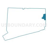
State House District 44, Connecticut
About

** Data sources from census 2010 **
Maps


Graphs


Neighbors
Neighoring State Legislative District Lower Chamber (by Name) Neighboring State Legislative District Lower Chamber on the Map
- State House District 29, RI
- State House District 40, RI
- State House District 45, CT
- State House District 47, CT
- State House District 50, CT
- State House District 51, CT
Top 10 Neighboring County (by Population) Neighboring County on the Map
- Providence County, RI (626,667)
- New London County, CT (274,055)
- Kent County, RI (166,158)
- Windham County, CT (118,428)
Top 10 Neighboring County Subdivision (by Population) Neighboring County Subdivision on the Map
- Coventry town, Kent County, RI (35,014)
- Killingly town, Windham County, CT (17,370)
- Plainfield town, Windham County, CT (15,405)
- Brooklyn town, Windham County, CT (8,210)
- West Greenwich town, Kent County, RI (6,135)
- Canterbury town, Windham County, CT (5,132)
- Foster town, Providence County, RI (4,606)
- Sterling town, Windham County, CT (3,830)
- Voluntown town, New London County, CT (2,603)
Top 10 Neighboring Place (by Population) Neighboring Place on the Map
- Danielson borough, CT (4,051)
- Moosup CDP, CT (3,231)
- Plainfield Village CDP, CT (2,557)
- East Brooklyn CDP, CT (1,638)
- Wauregan CDP, CT (1,205)
Top 10 Neighboring Elementary School District (by Population) Neighboring Elementary School District on the Map
- Exeter-West Greenwich Regional School District, RI (12,560)
- Brooklyn School District, CT (8,210)
- Canterbury School District, CT (5,132)
- Foster Elementary School District, RI (4,606)
- Sterling School District, CT (3,830)
- Voluntown School District, CT (2,603)
Top 10 Neighboring Secondary School District (by Population) Neighboring Secondary School District on the Map
Top 10 Neighboring Unified School District (by Population) Neighboring Unified School District on the Map
- Coventry School District, RI (35,014)
- Killingly School District, CT (17,370)
- Plainfield School District, CT (15,405)
Top 10 Neighboring State Legislative District Upper Chamber (by Population) Neighboring State Legislative District Upper Chamber on the Map
- State Senate District 29, CT (103,291)
- State Senate District 18, CT (102,472)
- State Senate District 34, RI (30,357)
- State Senate District 24, RI (27,542)
Top 10 Neighboring 111th Congressional District (by Population) Neighboring 111th Congressional District on the Map
Top 10 Neighboring Census Tract (by Population) Neighboring Census Tract on the Map
- Census Tract 9051, Windham County, CT (8,210)
- Census Tract 9041, Windham County, CT (7,466)
- Census Tract 208, Kent County, RI (6,135)
- Census Tract 9045, Windham County, CT (5,819)
- Census Tract 9072, Windham County, CT (5,506)
- Census Tract 9073, Windham County, CT (5,486)
- Census Tract 9061, Windham County, CT (5,132)
- Census Tract 133, Providence County, RI (4,606)
- Census Tract 9071, Windham County, CT (4,413)
- Census Tract 9044, Windham County, CT (4,085)
Top 10 Neighboring 5-Digit ZIP Code Tabulation Area (by Population) Neighboring 5-Digit ZIP Code Tabulation Area on the Map
- 06239, CT (11,183)
- 06374, CT (8,373)
- 06234, CT (8,244)
- 06241, CT (6,650)
- 06354, CT (6,141)
- 02817, RI (6,135)
- 02825, RI (5,377)
- 06331, CT (5,137)
- 06377, CT (2,962)
- 06384, CT (2,672)