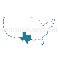
Alamo Area COG (Northeast)--Comal County PUMA, Texas
About
Outline
--Comal+County+PUMA%2c+Texas_A280.png)
Summary
| Unique Area Identifier | 194143 |
| Name | Alamo Area COG (Northeast)--Comal County PUMA |
| State | Texas |
| Area (square miles) | 574.88 |
| Land Area (square miles) | 559.48 |
| Water Area (square miles) | 15.40 |
| % of Land Area | 97.32 |
| % of Water Area | 2.68 |
| Latitude of the Internal Point | 29.80301930 |
| Longtitude of the Internal Point | -98.25520060 |
Maps
Graphs
Select a template below for downloading or customizing gragh for Alamo Area COG (Northeast)--Comal County PUMA, Texas
--Comal+County+PUMA%2c+Texas_T0.png)
--Comal+County+PUMA%2c+Texas_T1.png)
--Comal+County+PUMA%2c+Texas_T2.png)
--Comal+County+PUMA%2c+Texas_T3.png)
--Comal+County+PUMA%2c+Texas_T4.png)
--Comal+County+PUMA%2c+Texas_T5.png)
--Comal+County+PUMA%2c+Texas_T6.png)
--Comal+County+PUMA%2c+Texas_T7.png)
Neighbors
Neighoring Public Use Microdata Area (by Name) Neighboring Public Use Microdata Area on the Map
- Alamo Area COG (Northeast)--Guadalupe County PUMA, TX
- Alamo Area COG (Northwest) & Blanco County PUMA, TX
- Bexar County (North)--San Antonio City (Far North) & Timberwood Park PUMA, TX
- Bexar County (Northeast)--San Antonio (Northeast), Universal City & Converse Cities PUMA, TX
- Bexar County (Northwest)--San Antonio (Far Northwest) & Helotes Cities PUMA, TX
- Capital Area COG (Southwest)--Hays County PUMA, TX
Top 10 Neighboring County (by Population) Neighboring County on the Map
- Bexar County, TX (1,714,773)
- Hays County, TX (157,107)
- Guadalupe County, TX (131,533)
- Comal County, TX (108,472)
- Kendall County, TX (33,410)
- Blanco County, TX (10,497)
Top 10 Neighboring County Subdivision (by Population) Neighboring County Subdivision on the Map
- San Antonio North CCD, Bexar County, TX (309,717)
- San Antonio Northeast CCD, Bexar County, TX (233,237)
- Schertz-Cibolo CCD, Guadalupe County, TX (69,576)
- New Braunfels CCD, Comal County, TX (63,736)
- San Marcos CCD, Hays County, TX (55,314)
- Canyon Lake CCD, Comal County, TX (44,736)
- Seguin CCD, Guadalupe County, TX (40,992)
- Dripping Springs-Wimberley CCD, Hays County, TX (35,612)
- Boerne CCD, Kendall County, TX (27,018)
- Comfort CCD, Kendall County, TX (6,392)
Top 10 Neighboring Place (by Population) Neighboring Place on the Map
- San Antonio city, TX (1,327,407)
- New Braunfels city, TX (57,740)
- Schertz city, TX (31,465)
- Canyon Lake CDP, TX (21,262)
- Timberwood Park CDP, TX (13,447)
- Fair Oaks Ranch city, TX (5,986)
- Selma city, TX (5,540)
- Bulverde city, TX (4,630)
- Garden Ridge city, TX (3,259)
Top 10 Neighboring Unified School District (by Population) Neighboring Unified School District on the Map
- Judson Independent School District, TX (113,801)
- Comal Independent School District, TX (99,194)
- San Marcos Consolidated Independent School District, TX (64,257)
- Schertz-Cibolo-Universal City Independent School District, TX (58,437)
- New Braunfels Independent School District, TX (44,455)
- Boerne Independent School District, TX (34,875)
- Wimberley Independent School District, TX (13,009)
- Navarro Independent School District, TX (6,907)
- Blanco Independent School District, TX (6,615)
Top 10 Neighboring State Legislative District Lower Chamber (by Population) Neighboring State Legislative District Lower Chamber on the Map
- State House District 122, TX (246,846)
- State House District 45, TX (205,670)
- State House District 44, TX (194,258)
- State House District 73, TX (187,204)
- State House District 121, TX (158,873)
- State House District 118, TX (152,809)
Top 10 Neighboring State Legislative District Upper Chamber (by Population) Neighboring State Legislative District Upper Chamber on the Map
Top 10 Neighboring 111th Congressional District (by Population) Neighboring 111th Congressional District on the Map
- Congressional District 21, TX (856,954)
- Congressional District 28, TX (851,824)
- Congressional District 23, TX (847,651)
- Congressional District 25, TX (814,381)
Top 10 Neighboring Census Tract (by Population) Neighboring Census Tract on the Map
- Census Tract 1219.07, Bexar County, TX (9,329)
- Census Tract 106, Hays County, TX (9,265)
- Census Tract 2106.07, Guadalupe County, TX (8,024)
- Census Tract 104, Hays County, TX (7,934)
- Census Tract 2106.04, Guadalupe County, TX (7,557)
- Census Tract 3103, Comal County, TX (6,823)
- Census Tract 1821.01, Bexar County, TX (6,601)
- Census Tract 9701, Kendall County, TX (6,392)
- Census Tract 9704.02, Kendall County, TX (6,332)
- Census Tract 1918.04, Bexar County, TX (6,322)
Top 10 Neighboring 5-Digit ZIP Code Tabulation Area (by Population) Neighboring 5-Digit ZIP Code Tabulation Area on the Map
- 78666, TX (63,836)
- 78130, TX (59,546)
- 78155, TX (45,341)
- 78154, TX (30,347)
- 78108, TX (27,770)
- 78006, TX (27,558)
- 78260, TX (24,844)
- 78132, TX (19,139)
- 78133, TX (16,269)
- 78070, TX (14,618)


--Comal+County+PUMA in Texas.png)

--Comal+County+PUMA%2c+Texas.png)