


Land Between the Lakes--Weakley, Henry, Carroll, Humphreys, Benton & Houston Counties PUMA, Tennessee
About
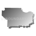
Outline

Summary
| Unique Area Identifier | 194018 |
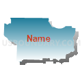
| Name | Land Between the Lakes--Weakley, Henry, Carroll, Humphreys, Benton & Houston Counties PUMA |
| State | Tennessee |
| Area (square miles) | 2,975.19 |
| Land Area (square miles) | 2,867.12 |
| Water Area (square miles) | 108.07 |
| % of Land Area | 96.37 |
| % of Water Area | 3.63 |
| Latitude of the Internal Point | 36.15565830 |
| Longtitude of the Internal Point | -88.23928820 |
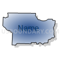
Maps


Graphs
Select a template below for downloading or customizing gragh for Land Between the Lakes--Weakley, Henry, Carroll, Humphreys, Benton & Houston Counties PUMA, Tennessee


Neighbors
Neighoring Public Use Microdata Area (by Name) Neighboring Public Use Microdata Area on the Map
- Henderson, Hardeman, McNairy, Hardin, Haywood & Decatur Counties PUMA, TN
- Lawrence, Giles, Wayne, Lewis & Perry Counties PUMA, TN
- Madison & Chester Counties--Jackson City PUMA, TN
- Montgomery & Stewart Counties--Clarksville City PUMA, TN
- Northwest Tennessee--Gibson, Dyer, Obion, Crockett & Lake Counties PUMA, TN
- Purchase Area Development District PUMA, KY
- Robertson, Dickson, Cheatham & Hickman Counties PUMA, TN
Top 10 Neighboring County (by Population) Neighboring County on the Map
- Montgomery County, TN (172,331)
- Madison County, TN (98,294)
- Gibson County, TN (49,683)
- Dickson County, TN (49,666)
- Calloway County, KY (37,191)
- Graves County, KY (37,121)
- Weakley County, TN (35,021)
- Henry County, TN (32,330)
- Obion County, TN (31,807)
- Carroll County, TN (28,522)
Top 10 Neighboring County Subdivision (by Population) Neighboring County Subdivision on the Map
- District 10, Madison County, TN (9,943)
- District 1, Gibson County, TN (9,411)
- District 3, Henry County, TN (7,032)
- District 4, Montgomery County, TN (6,941)
- District 6, Montgomery County, TN (6,645)
- District 5, Henry County, TN (6,454)
- District 2, Henry County, TN (6,291)
- District 1, Henry County, TN (6,288)
- District 4, Henry County, TN (6,265)
- District 9, Carroll County, TN (4,628)
Top 10 Neighboring Place (by Population) Neighboring Place on the Map
- Martin city, TN (11,473)
- Paris city, TN (10,156)
- McKenzie city, TN (5,310)
- Waverly city, TN (4,105)
- Huntingdon town, TN (3,985)
- Camden city, TN (3,582)
- Dresden town, TN (3,005)
- Greenfield city, TN (2,182)
- New Johnsonville city, TN (1,951)
- McEwen city, TN (1,750)
Top 10 Neighboring Elementary School District (by Population) Neighboring Elementary School District on the Map
Top 10 Neighboring Secondary School District (by Population) Neighboring Secondary School District on the Map
Top 10 Neighboring Unified School District (by Population) Neighboring Unified School District on the Map
- Montgomery County School District, TN (166,179)
- Jackson-Madison Consolidated School District, TN (98,294)
- Dickson County School District, TN (49,666)
- Weakley County School District, TN (35,021)
- Graves County School District, KY (27,496)
- Calloway County School District, KY (26,537)
- Hickman County School District, TN (24,690)
- Obion County School District, TN (20,975)
- Henry County School District, TN (20,665)
- Henderson County School District, TN (20,117)
Top 10 Neighboring State Legislative District Lower Chamber (by Population) Neighboring State Legislative District Lower Chamber on the Map
- State House District 78, TN (66,061)
- State House District 72, TN (63,136)
- State House District 69, TN (62,378)
- State House District 75, TN (62,143)
- State House District 73, TN (60,027)
- State House District 77, TN (59,592)
- State House District 74, TN (58,574)
- State House District 79, TN (57,616)
- State House District 76, TN (55,610)
- State House District 5, KY (41,952)
Top 10 Neighboring State Legislative District Upper Chamber (by Population) Neighboring State Legislative District Upper Chamber on the Map
- State Senate District 22, TN (219,862)
- State Senate District 24, TN (184,244)
- State Senate District 27, TN (176,499)
- State Senate District 25, TN (176,409)
- State Senate District 1, KY (113,784)
Top 10 Neighboring 111th Congressional District (by Population) Neighboring 111th Congressional District on the Map
- Congressional District 7, TN (792,605)
- Congressional District 1, KY (686,989)
- Congressional District 8, TN (658,258)
Top 10 Neighboring Census Tract (by Population) Neighboring Census Tract on the Map
- Census Tract 1017, Montgomery County, TN (8,091)
- Census Tract 9696, Henry County, TN (7,898)
- Census Tract 9621, Carroll County, TN (6,823)
- Census Tract 9684, Weakley County, TN (5,894)
- Census Tract 15.02, Madison County, TN (5,890)
- Census Tract 9671, Gibson County, TN (5,850)
- Census Tract 1303, Humphreys County, TN (5,599)
- Census Tract 9752, Henderson County, TN (5,490)
- Census Tract 1301, Humphreys County, TN (5,399)
- Census Tract 9664, Gibson County, TN (5,197)
Top 10 Neighboring 5-Digit ZIP Code Tabulation Area (by Population) Neighboring 5-Digit ZIP Code Tabulation Area on the Map
- 38305, TN (49,808)
- 37055, TN (27,024)
- 38242, TN (20,151)
- 38351, TN (17,603)
- 38261, TN (16,919)
- 38237, TN (16,627)
- 38358, TN (12,121)
- 38320, TN (10,686)
- 38201, TN (10,093)
- 38344, TN (8,684)