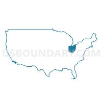
Cleveland City (Central) PUMA, Ohio
About
Outline
+PUMA%2c+Ohio_A280.png)
Summary
| Unique Area Identifier | 193701 |
| Name | Cleveland City (Central) PUMA |
| State | Ohio |
| Area (square miles) | 805.72 |
| Land Area (square miles) | 27.19 |
| Water Area (square miles) | 778.53 |
| % of Land Area | 3.38 |
| % of Water Area | 96.62 |
| Latitude of the Internal Point | 41.74972750 |
| Longtitude of the Internal Point | -81.72621450 |
Maps
Graphs
Select a template below for downloading or customizing gragh for Cleveland City (Central) PUMA, Ohio
+PUMA%2c+Ohio_T0.png)
+PUMA%2c+Ohio_T1.png)
+PUMA%2c+Ohio_T2.png)
+PUMA%2c+Ohio_T3.png)
+PUMA%2c+Ohio_T4.png)
+PUMA%2c+Ohio_T5.png)
+PUMA%2c+Ohio_T6.png)
+PUMA%2c+Ohio_T7.png)
Neighbors
Neighoring Public Use Microdata Area (by Name) Neighboring Public Use Microdata Area on the Map
- Cleveland City (East) & Bratenahl Village PUMA, OH
- Cleveland City (West) PUMA, OH
- Cuyahoga County (Northeast)--Euclid, Cleveland Heights & South Euclid Cities PUMA, OH
- Cuyahoga County (South Central)--Brooklyn, Parma, Parma Heights & Seven Hills Cities PUMA, OH
- Cuyahoga County (Southeast)--Bedford, Garfield Heights & Maple Heights Cities PUMA, OH
- Cuyahoga County (West)--Berea, Brook Park, Lakewood & Rocky River Cities PUMA, OH
- Cuyahoga County--Olmsted Township, Bay Village, North Olmsted & Westlake Cities PUMA, OH
- Lake County (West)--Eastlake, Wickliffe, Willoughby & Willowick Cities PUMA, OH
- Lorain County (North)--Elyria & Lorain Cities PUMA, OH
- Lorain County (South)--Avon, Avon Lake & North Ridgeville Cities PUMA, OH
Top 10 Neighboring County (by Population) Neighboring County on the Map
Top 10 Neighboring County Subdivision (by Population) Neighboring County Subdivision on the Map
- Cleveland city, Cuyahoga County, OH (396,815)
- Parma city, Cuyahoga County, OH (81,601)
- Lakewood city, Cuyahoga County, OH (52,131)
- Euclid city, Cuyahoga County, OH (48,920)
- Garfield Heights city, Cuyahoga County, OH (28,849)
- Rocky River city, Cuyahoga County, OH (20,213)
- Bay Village city, Cuyahoga County, OH (15,651)
- Brooklyn city, Cuyahoga County, OH (11,169)
- Newburgh Heights village, Cuyahoga County, OH (2,167)
- Brooklyn Heights village, Cuyahoga County, OH (1,543)
Top 10 Neighboring Place (by Population) Neighboring Place on the Map
- Cleveland city, OH (396,815)
- Parma city, OH (81,601)
- Lakewood city, OH (52,131)
- Euclid city, OH (48,920)
- Garfield Heights city, OH (28,849)
- Rocky River city, OH (20,213)
- Bay Village city, OH (15,651)
- Brooklyn city, OH (11,169)
- Newburgh Heights village, OH (2,167)
- Brooklyn Heights village, OH (1,543)
Top 10 Neighboring Unified School District (by Population) Neighboring Unified School District on the Map
- Cleveland Municipal School District, OH (399,046)
- Parma City School District, OH (114,098)
- Garfield Heights City School District, OH (26,480)
- Brooklyn City School District, OH (11,169)
- Cuyahoga Heights Local School District, OH (4,215)
- School District Not Defined (Water), OH (4)
Top 10 Neighboring State Legislative District Lower Chamber (by Population) Neighboring State Legislative District Lower Chamber on the Map
- State House District 15, OH (108,895)
- State House District 13, OH (99,462)
- State House District 12, OH (98,837)
- State House District 11, OH (94,163)
- State House District 10, OH (92,627)
- State House Districts not defined, OH (0)
Top 10 Neighboring State Legislative District Upper Chamber (by Population) Neighboring State Legislative District Upper Chamber on the Map
- State Senate District 23, OH (311,985)
- State Senate District 25, OH (306,356)
- State Senate District 21, OH (280,358)
- State Senate Districts not defined, OH (0)
Top 10 Neighboring 111th Congressional District (by Population) Neighboring 111th Congressional District on the Map
- Congressional District 13, OH (649,102)
- Congressional District 10, OH (599,205)
- Congressional District 11, OH (540,432)
Top 10 Neighboring Census Tract (by Population) Neighboring Census Tract on the Map
- Census Tract 974, Lorain County, OH (10,233)
- Census Tract 1811, Cuyahoga County, OH (6,814)
- Census Tract 1773.03, Cuyahoga County, OH (4,988)
- Census Tract 1606.01, Cuyahoga County, OH (4,966)
- Census Tract 1177, Cuyahoga County, OH (4,899)
- Census Tract 1027, Cuyahoga County, OH (4,553)
- Census Tract 1301.03, Cuyahoga County, OH (4,526)
- Census Tract 1371.02, Cuyahoga County, OH (4,455)
- Census Tract 1087.01, Cuyahoga County, OH (4,393)
- Census Tract 1371.03, Cuyahoga County, OH (4,229)
Top 10 Neighboring 5-Digit ZIP Code Tabulation Area (by Population) Neighboring 5-Digit ZIP Code Tabulation Area on the Map
- 44107, OH (52,244)
- 44102, OH (45,014)
- 44109, OH (40,646)
- 44105, OH (40,089)
- 44134, OH (38,800)
- 44129, OH (29,090)
- 44125, OH (28,730)
- 44108, OH (25,679)
- 44104, OH (22,640)
- 44012, OH (22,581)


+PUMA in Ohio.png)

+PUMA%2c+Ohio.png)