


Allen County PUMA, Ohio
About
Outline

Summary
| Unique Area Identifier | 193724 |
| Name | Allen County PUMA |
| State | Ohio |
| Area (square miles) | 406.85 |
| Land Area (square miles) | 402.50 |
| Water Area (square miles) | 4.35 |
| % of Land Area | 98.93 |
| % of Water Area | 1.07 |
| Latitude of the Internal Point | 40.77152800 |
| Longtitude of the Internal Point | -84.10654560 |
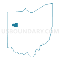
Maps

Graphs
Select a template below for downloading or customizing gragh for Allen County PUMA, Ohio


Neighbors
Neighoring Public Use Microdata Area (by Name) Neighboring Public Use Microdata Area on the Map
- Auglaize, Mercer & Van Wert Counties PUMA, OH
- Hancock & Putnam Counties PUMA, OH
- Logan, Champaign & Hardin Counties PUMA, OH
Top 10 Neighboring County (by Population) Neighboring County on the Map
- Allen County, OH (106,331)
- Hancock County, OH (74,782)
- Auglaize County, OH (45,949)
- Putnam County, OH (34,499)
- Hardin County, OH (32,058)
- Van Wert County, OH (28,744)
Top 10 Neighboring County Subdivision (by Population) Neighboring County Subdivision on the Map
- Lima city, Allen County, OH (38,771)
- Duchouquet township, Auglaize County, OH (14,499)
- American township, Allen County, OH (14,381)
- Shawnee township, Allen County, OH (12,433)
- Bath township, Allen County, OH (9,725)
- Liberty township, Hardin County, OH (7,712)
- Marion township, Allen County, OH (6,715)
- Richland township, Allen County, OH (6,289)
- Washington township, Van Wert County, OH (5,131)
- Pleasant township, Putnam County, OH (3,804)
Top 10 Neighboring Place (by Population) Neighboring Place on the Map
- Lima city, OH (38,771)
- Delphos city, OH (7,101)
- Bluffton village, OH (4,125)
- Fort Shawnee village, OH (3,726)
- Spencerville village, OH (2,223)
- Elida village, OH (1,905)
- Cridersville village, OH (1,852)
- Cairo village, OH (524)
- Lafayette village, OH (445)
- Harrod village, OH (417)
Top 10 Neighboring Unified School District (by Population) Neighboring Unified School District on the Map
- Lima City School District, OH (29,740)
- Elida Local School District, OH (19,185)
- Wapakoneta City School District, OH (19,151)
- Shawnee Local School District, OH (16,870)
- Bath Local School District, OH (13,970)
- Delphos City School District, OH (9,874)
- Ada Exempted Village School District, OH (7,951)
- Bluffton Exempted Village School District, OH (6,884)
- Allen East Local School District, OH (5,853)
- Spencerville Local School District, OH (5,184)
Top 10 Neighboring State Legislative District Lower Chamber (by Population) Neighboring State Legislative District Lower Chamber on the Map
- State House District 78, OH (121,455)
- State House District 76, OH (120,854)
- State House District 75, OH (112,019)
- State House District 4, OH (106,331)
Top 10 Neighboring State Legislative District Upper Chamber (by Population) Neighboring State Legislative District Upper Chamber on the Map
Top 10 Neighboring 111th Congressional District (by Population) Neighboring 111th Congressional District on the Map
Top 10 Neighboring Census Tract (by Population) Neighboring Census Tract on the Map
- Census Tract 108, Allen County, OH (7,994)
- Census Tract 113, Allen County, OH (7,559)
- Census Tract 4, Hardin County, OH (6,651)
- Census Tract 110, Allen County, OH (5,445)
- Census Tract 106, Allen County, OH (5,138)
- Census Tract 13, Hancock County, OH (5,082)
- Census Tract 405, Auglaize County, OH (5,021)
- Census Tract 307, Putnam County, OH (4,980)
- Census Tract 109, Allen County, OH (4,515)
- Census Tract 101, Allen County, OH (4,405)
Top 10 Neighboring 5-Digit ZIP Code Tabulation Area (by Population) Neighboring 5-Digit ZIP Code Tabulation Area on the Map
- 45801, OH (25,303)
- 45805, OH (22,514)
- 45895, OH (17,945)
- 45804, OH (15,758)
- 45807, OH (12,221)
- 45806, OH (11,158)
- 45833, OH (10,667)
- 45810, OH (8,460)
- 45817, OH (6,736)
- 45830, OH (6,228)