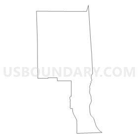
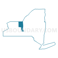
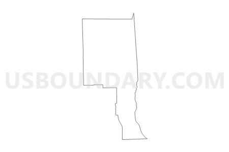
Wayne & Seneca Counties PUMA, New York
About
Outline

Summary
| Unique Area Identifier | 193500 |
| Name | Wayne & Seneca Counties PUMA |
| State | New York |
| Area (square miles) | 1,773.49 |
| Land Area (square miles) | 927.53 |
| Water Area (square miles) | 845.96 |
| % of Land Area | 52.30 |
| % of Water Area | 47.70 |
| Latitude of the Internal Point | 43.20377300 |
| Longtitude of the Internal Point | -76.99609420 |
Maps
Graphs
Select a template below for downloading or customizing gragh for Wayne & Seneca Counties PUMA, New York


Neighbors
Neighoring Public Use Microdata Area (by Name) Neighboring Public Use Microdata Area on the Map
- Cayuga & Onondaga (South) Counties PUMA, NY
- Monroe County (East) PUMA, NY
- Monroe County (North & West) PUMA, NY
- Monroe County (South) PUMA, NY
- Ontario & Yates Counties PUMA, NY
- Steuben (North & West), Schuyler & Chemung (North) Counties PUMA, NY
- Tompkins County PUMA, NY
Top 10 Neighboring County (by Population) Neighboring County on the Map
- Monroe County, NY (744,344)
- Ontario County, NY (107,931)
- Tompkins County, NY (101,564)
- Wayne County, NY (93,772)
- Cayuga County, NY (80,026)
- Seneca County, NY (35,251)
- Yates County, NY (25,348)
- Schuyler County, NY (18,343)
Top 10 Neighboring County Subdivision (by Population) Neighboring County Subdivision on the Map
- Perinton town, Monroe County, NY (46,462)
- Webster town, Monroe County, NY (42,641)
- Penfield town, Monroe County, NY (36,242)
- Victor town, Ontario County, NY (14,275)
- Arcadia town, Wayne County, NY (14,244)
- Geneva city, Ontario County, NY (13,261)
- Farmington town, Ontario County, NY (11,825)
- Lansing town, Tompkins County, NY (11,033)
- Ontario town, Wayne County, NY (10,136)
- Walworth town, Wayne County, NY (9,449)
Top 10 Neighboring Place (by Population) Neighboring Place on the Map
- Geneva city, NY (13,261)
- Newark village, NY (9,145)
- Seneca Falls village, NY (6,681)
- Waterloo village, NY (5,171)
- Lyons village, NY (3,619)
- Palmyra village, NY (3,536)
- Williamson CDP, NY (2,495)
- Ontario CDP, NY (2,160)
- Clyde village, NY (2,093)
- Sodus village, NY (1,819)
Top 10 Neighboring Unified School District (by Population) Neighboring Unified School District on the Map
- Webster Central School District, NY (55,982)
- Fairport Central School District, NY (40,174)
- Penfield Central School District, NY (30,712)
- Victor Central School District, NY (22,766)
- Geneva City School District, NY (17,490)
- Penn Yan Central School District, NY (15,221)
- Newark Central School District, NY (15,174)
- Wayne Central School District, NY (15,070)
- School District Not Defined, NY (13,644)
- Palmyra-Macedon Central School District, NY (13,054)
Top 10 Neighboring State Legislative District Lower Chamber (by Population) Neighboring State Legislative District Lower Chamber on the Map
- Assembly District 130, NY (139,115)
- Assembly District 135, NY (131,932)
- Assembly District 125, NY (131,678)
- Assembly District 129, NY (130,747)
- Assembly District 128, NY (126,373)
- Assembly District 136, NY (124,338)
- Assembly District 123, NY (124,261)
- Assembly District 137, NY (123,427)
Top 10 Neighboring State Legislative District Upper Chamber (by Population) Neighboring State Legislative District Upper Chamber on the Map
- State Senate District 55, NY (309,516)
- State Senate District 54, NY (302,881)
- State Senate District 49, NY (296,854)
- State Senate District 53, NY (295,046)
Top 10 Neighboring 111th Congressional District (by Population) Neighboring 111th Congressional District on the Map
- Congressional District 25, NY (668,869)
- Congressional District 29, NY (663,727)
- Congressional District 24, NY (657,222)
- Congressional District 28, NY (611,838)
Top 10 Neighboring Census Tract (by Population) Neighboring Census Tract on the Map
- Census Tract 501.02, Ontario County, NY (10,803)
- Census Tract 117.03, Monroe County, NY (8,605)
- Census Tract 114, Monroe County, NY (8,250)
- Census Tract 113.01, Monroe County, NY (7,878)
- Census Tract 504, Ontario County, NY (7,072)
- Census Tract 117.07, Monroe County, NY (6,776)
- Census Tract 115.01, Monroe County, NY (6,667)
- Census Tract 210, Wayne County, NY (6,470)
- Census Tract 502.01, Ontario County, NY (6,192)
- Census Tract 9508, Seneca County, NY (6,173)
Top 10 Neighboring 5-Digit ZIP Code Tabulation Area (by Population) Neighboring 5-Digit ZIP Code Tabulation Area on the Map
- 14580, NY (50,587)
- 14450, NY (41,104)
- 14456, NY (20,087)
- 14564, NY (14,487)
- 14513, NY (13,976)
- 14527, NY (12,820)
- 14519, NY (11,581)
- 13148, NY (10,750)
- 13165, NY (10,741)
- 14425, NY (10,717)


