


Boone County PUMA, Missouri
About
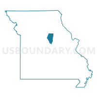
Outline

Summary
| Unique Area Identifier | 193288 |
| Name | Boone County PUMA |
| State | Missouri |
| Area (square miles) | 690.98 |
| Land Area (square miles) | 685.41 |
| Water Area (square miles) | 5.57 |
| % of Land Area | 99.19 |
| % of Water Area | 0.81 |
| Latitude of the Internal Point | 38.98965700 |
| Longtitude of the Internal Point | -92.31077860 |
Maps

Graphs
Select a template below for downloading or customizing gragh for Boone County PUMA, Missouri


Neighbors
Neighoring Public Use Microdata Area (by Name) Neighboring Public Use Microdata Area on the Map
- Cole, Callaway, Moniteau & Osage Counties PUMA, MO
- Lincoln, Warren, Audrain, Pike & Montgomery Counties PUMA, MO
- Pettis, Randolph, Saline, Cooper, Howard, Carroll & Chariton Counties PUMA, MO
Top 10 Neighboring County (by Population) Neighboring County on the Map
- Boone County, MO (162,642)
- Cole County, MO (75,990)
- Callaway County, MO (44,332)
- Audrain County, MO (25,529)
- Randolph County, MO (25,414)
- Cooper County, MO (17,601)
- Moniteau County, MO (15,607)
- Howard County, MO (10,144)
Top 10 Neighboring County Subdivision (by Population) Neighboring County Subdivision on the Map
- Columbia township, Boone County, MO (62,961)
- Missouri township, Boone County, MO (58,199)
- Jefferson township, Cole County, MO (54,165)
- Summit township, Callaway County, MO (8,873)
- Rocky Fork township, Boone County, MO (8,397)
- Rock Bridge township, Boone County, MO (8,261)
- Three Creeks township, Boone County, MO (5,133)
- Centralia township, Boone County, MO (4,906)
- Prairie township, Randolph County, MO (4,259)
- Cedar township, Boone County, MO (4,190)
Top 10 Neighboring Place (by Population) Neighboring Place on the Map
- Columbia city, MO (108,500)
- Centralia city, MO (4,027)
- Ashland city, MO (3,707)
- Hallsville city, MO (1,491)
- Sturgeon city, MO (872)
- Clark city, MO (298)
- Harrisburg town, MO (266)
- Rocheport city, MO (239)
- Hartsburg town, MO (103)
- Pierpont village, MO (76)
Top 10 Neighboring Elementary School District (by Population) Neighboring Elementary School District on the Map
Top 10 Neighboring Unified School District (by Population) Neighboring Unified School District on the Map
- Columbia Public Schools, MO (136,836)
- Jefferson City Public Schools, MO (71,991)
- Fulton School District, MO (19,130)
- Boonville School District, MO (11,591)
- Southern Boone County R-I School District, MO (7,932)
- Boone County R-IV School District, MO (7,263)
- Centralia R-VI School District, MO (7,249)
- North Callaway R-I School District, MO (6,857)
- Fayette R-III School District, MO (5,145)
- New Bloomfield R-III School District, MO (4,232)
Top 10 Neighboring State Legislative District Lower Chamber (by Population) Neighboring State Legislative District Lower Chamber on the Map
- State House District 24, MO (46,896)
- State House District 25, MO (40,532)
- State House District 21, MO (39,438)
- State House District 23, MO (39,185)
- State House District 20, MO (38,233)
- State House District 9, MO (36,616)
- State House District 114, MO (36,525)
- State House District 117, MO (35,534)
- State House District 22, MO (34,437)
Top 10 Neighboring State Legislative District Upper Chamber (by Population) Neighboring State Legislative District Upper Chamber on the Map
- State Senate District 19, MO (188,056)
- State Senate District 6, MO (181,242)
- State Senate District 21, MO (163,305)
- State Senate District 18, MO (159,547)
Top 10 Neighboring 111th Congressional District (by Population) Neighboring 111th Congressional District on the Map
- Congressional District 6, MO (693,974)
- Congressional District 9, MO (684,101)
- Congressional District 4, MO (679,375)
Top 10 Neighboring Census Tract (by Population) Neighboring Census Tract on the Map
- Census Tract 14, Boone County, MO (11,433)
- Census Tract 11.04, Boone County, MO (10,629)
- Census Tract 15.04, Boone County, MO (9,106)
- Census Tract 18.05, Boone County, MO (9,020)
- Census Tract 11.01, Boone County, MO (8,628)
- Census Tract 19.02, Boone County, MO (8,249)
- Census Tract 16.01, Boone County, MO (8,052)
- Census Tract 17.01, Boone County, MO (6,909)
- Census Tract 22, Boone County, MO (6,753)
- Census Tract 11.03, Boone County, MO (6,714)
Top 10 Neighboring 5-Digit ZIP Code Tabulation Area (by Population) Neighboring 5-Digit ZIP Code Tabulation Area on the Map
- 65203, MO (53,307)
- 65202, MO (46,547)
- 65201, MO (39,417)
- 65109, MO (38,090)
- 65101, MO (30,587)
- 65251, MO (22,437)
- 65233, MO (11,703)
- 65240, MO (7,590)
- 65010, MO (5,704)
- 65248, MO (4,619)