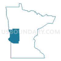
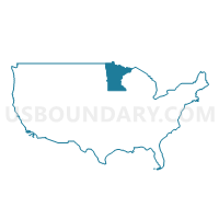
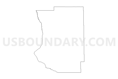
West Central Minnesota PUMA, Minnesota
About
Outline
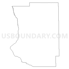
Summary
| Unique Area Identifier | 193214 |
| Name | West Central Minnesota PUMA |
| State | Minnesota |
| Area (square miles) | 7,429.78 |
| Land Area (square miles) | 6,956.81 |
| Water Area (square miles) | 472.97 |
| % of Land Area | 93.63 |
| % of Water Area | 6.37 |
| Latitude of the Internal Point | 45.94642920 |
| Longtitude of the Internal Point | -95.88544850 |
Maps
Graphs
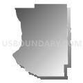
Select a template below for downloading or customizing gragh for West Central Minnesota PUMA, Minnesota




Neighbors
Neighoring Public Use Microdata Area (by Name) Neighboring Public Use Microdata Area on the Map
- Beltrami, Becker, Hubbard, Clearwater, Mahnomen & Lake of the Woods Counties PUMA, MN
- Brown, Lyon, Redwood, Chippewa, Yellow Medicine, Lac qui Parle & Lincoln Counties PUMA, MN
- Clay, Polk, Roseau, Pennington, Marshall, Norman, Kittson & Red Lake Counties PUMA, MN
- Crow Wing, Morrison, Todd & Wadena Counties PUMA, MN
- East Central North Dakota--Jamestown City PUMA, ND
- Kandiyohi, McLeod, Meeker, Renville & Sibley Counties PUMA, MN
- Northeast South Dakota PUMA, SD
- Stearns County--St. Cloud City PUMA, MN
Top 10 Neighboring County (by Population) Neighboring County on the Map
- Stearns County, MN (150,642)
- Clay County, MN (58,999)
- Otter Tail County, MN (57,303)
- Kandiyohi County, MN (42,239)
- Douglas County, MN (36,009)
- Becker County, MN (32,504)
- Todd County, MN (24,895)
- Richland County, ND (16,321)
- Wadena County, MN (13,843)
- Chippewa County, MN (12,441)
Top 10 Neighboring County Subdivision (by Population) Neighboring County Subdivision on the Map
- Fergus Falls city, Otter Tail County, MN (13,138)
- Alexandria city, Douglas County, MN (11,070)
- Wahpeton city, Richland County, ND (7,766)
- Morris city, Stevens County, MN (5,286)
- La Grand township, Douglas County, MN (4,210)
- Alexandria township, Douglas County, MN (4,098)
- Wadena city, Wadena County, MN (4,022)
- Breckenridge city, Wilkin County, MN (3,386)
- Benson city, Swift County, MN (3,240)
- Perham city, Otter Tail County, MN (2,985)
Top 10 Neighboring Place (by Population) Neighboring Place on the Map
- Fergus Falls city, MN (13,138)
- Alexandria city, MN (11,070)
- Wahpeton city, ND (7,766)
- Morris city, MN (5,286)
- Wadena city, MN (4,088)
- Breckenridge city, MN (3,386)
- Benson city, MN (3,240)
- Perham city, MN (2,985)
- Glenwood city, MN (2,564)
- Pelican Rapids city, MN (2,464)
Top 10 Neighboring Unified School District (by Population) Neighboring Unified School District on the Map
- Alexandria Public School District, MN (28,885)
- Fergus Falls Public School District, MN (19,386)
- Detroit Lakes Public School District, MN (16,612)
- Perham Public School District, MN (10,315)
- Wahpeton Public School District 37, ND (9,424)
- Minnewaska School District, MN (9,402)
- Sisseton School District 54-2, SD (7,853)
- Wadena-Deer Creek School District, MN (7,754)
- Sauk Centre Public School District, MN (7,628)
- Montevideo Public School District, MN (7,599)
Top 10 Neighboring State Legislative District Lower Chamber (by Population) Neighboring State Legislative District Lower Chamber on the Map
- State House District 9B, MN (39,347)
- State House District 11B, MN (39,156)
- State House District 13A, MN (38,763)
- State House District 13B, MN (37,827)
- State House District 10B, MN (37,598)
- State House District 11A, MN (37,492)
- State House District 2A, MN (37,063)
- State House District 10A, MN (35,993)
- State House District 20B, MN (34,629)
- State House District 20A, MN (32,187)
Top 10 Neighboring State Legislative District Upper Chamber (by Population) Neighboring State Legislative District Upper Chamber on the Map
- State Senate District 9, MN (81,765)
- State Senate District 2, MN (76,807)
- State Senate District 11, MN (76,648)
- State Senate District 13, MN (76,590)
- State Senate District 10, MN (73,591)
- State Senate District 20, MN (66,816)
- State Senate District 4, SD (20,558)
- State Senate District 1, SD (20,515)
- State Senate District 25, ND (13,025)
Top 10 Neighboring 111th Congressional District (by Population) Neighboring 111th Congressional District on the Map
- Congressional District (at Large), SD (814,180)
- Congressional District (at Large), ND (672,591)
- Congressional District 8, MN (660,342)
- Congressional District 7, MN (625,512)
Top 10 Neighboring Census Tract (by Population) Neighboring Census Tract on the Map
- Census Tract 301.04, Clay County, MN (6,882)
- Census Tract 115, Stearns County, MN (6,274)
- Census Tract 4506, Douglas County, MN (5,966)
- Census Tract 4802, Wadena County, MN (5,682)
- Census Tract 9609, Otter Tail County, MN (5,383)
- Census Tract 9531, Grant County, SD (5,239)
- Census Tract 7806, Kandiyohi County, MN (5,097)
- Census Tract 4503, Becker County, MN (4,962)
- Census Tract 9605, Otter Tail County, MN (4,894)
- Census Tract 4803, Wadena County, MN (4,876)
Top 10 Neighboring 5-Digit ZIP Code Tabulation Area (by Population) Neighboring 5-Digit ZIP Code Tabulation Area on the Map
- 56560, MN (40,766)
- 56308, MN (23,961)
- 56537, MN (18,548)
- 56501, MN (16,290)
- 58075, ND (9,276)
- 56378, MN (7,778)
- 56265, MN (7,757)
- 56267, MN (6,807)
- 56482, MN (6,666)
- 56573, MN (5,993)


