


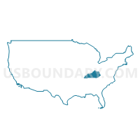
Bluegrass Area Development District (Southeast) PUMA, Kentucky
About
Outline
+PUMA%2c+Kentucky_A280.png)
Summary
| Unique Area Identifier | 192982 |
| Name | Bluegrass Area Development District (Southeast) PUMA |
| State | Kentucky |
| Area (square miles) | 878.99 |
| Land Area (square miles) | 869.35 |
| Water Area (square miles) | 9.64 |
| % of Land Area | 98.90 |
| % of Water Area | 1.10 |
| Latitude of the Internal Point | 37.72713940 |
| Longtitude of the Internal Point | -84.08722250 |
Maps
+PUMA in Kentucky.png)
Graphs
Select a template below for downloading or customizing gragh for Bluegrass Area Development District (Southeast) PUMA, Kentucky
+PUMA%2c+Kentucky_T0.png)
+PUMA%2c+Kentucky_T1.png)
+PUMA%2c+Kentucky_T2.png)
+PUMA%2c+Kentucky_T3.png)
+PUMA%2c+Kentucky_T4.png)
+PUMA%2c+Kentucky_T5.png)
+PUMA%2c+Kentucky_T6.png)
+PUMA%2c+Kentucky_T7.png)
+PUMA%2c+Kentucky.png)
Neighbors
Neighoring Public Use Microdata Area (by Name) Neighboring Public Use Microdata Area on the Map
- Bluegrass Area Development District (Central)--Lexington-Fayette County (Outer) PUMA, KY
- Bluegrass Area Development District (Northeast) PUMA, KY
- Bluegrass Area Development District (South) PUMA, KY
- Buffalo Trace & Gateway Area Development Districts PUMA, KY
- Cumberland Valley Area Development District (North) PUMA, KY
- Kentucky River Area Development District PUMA, KY
Top 10 Neighboring County (by Population) Neighboring County on the Map
- Fayette County, KY (295,803)
- Madison County, KY (82,916)
- Jessamine County, KY (48,586)
- Clark County, KY (35,613)
- Montgomery County, KY (26,499)
- Rockcastle County, KY (17,056)
- Garrard County, KY (16,912)
- Estill County, KY (14,672)
- Jackson County, KY (13,494)
- Powell County, KY (12,613)
Top 10 Neighboring County Subdivision (by Population) Neighboring County Subdivision on the Map
- Lexington-Fayette Southeast CCD, Fayette County, KY (69,590)
- Richmond CCD, Madison County, KY (39,880)
- Nicholasville CCD, Jessamine County, KY (34,625)
- Winchester CCD, Clark County, KY (29,984)
- Berea CCD, Madison County, KY (23,635)
- Boonesborough-White Hall CCD, Madison County, KY (8,863)
- Jeffersonville CCD, Montgomery County, KY (7,719)
- Lancaster CCD, Garrard County, KY (7,697)
- Stanton CCD, Powell County, KY (6,453)
- Waco-Bybee CCD, Madison County, KY (6,219)
Top 10 Neighboring Place (by Population) Neighboring Place on the Map
- Lexington-Fayette urban county, KY (295,803)
- Richmond city, KY (31,364)
- Berea city, KY (13,561)
- Stanton city, KY (2,733)
- Irvine city, KY (2,715)
- Clay City city, KY (1,077)
- Ravenna city, KY (605)
Top 10 Neighboring Unified School District (by Population) Neighboring Unified School District on the Map
- Fayette County School District, KY (295,803)
- Madison County School District, KY (76,271)
- Jessamine County School District, KY (48,586)
- Clark County School District, KY (35,613)
- Montgomery County School District, KY (26,499)
- Rockcastle County School District, KY (17,056)
- Garrard County School District, KY (16,912)
- Estill County School District, KY (14,672)
- Jackson County School District, KY (13,494)
- Powell County School District, KY (12,613)
Top 10 Neighboring State Legislative District Lower Chamber (by Population) Neighboring State Legislative District Lower Chamber on the Map
- State House District 88, KY (49,790)
- State House District 39, KY (49,138)
- State House District 81, KY (46,960)
- State House District 36, KY (45,022)
- State House District 80, KY (44,415)
- State House District 74, KY (43,768)
- State House District 73, KY (43,459)
- State House District 89, KY (42,731)
- State House District 71, KY (38,856)
- State House District 91, KY (36,437)
Top 10 Neighboring State Legislative District Upper Chamber (by Population) Neighboring State Legislative District Upper Chamber on the Map
- State Senate District 22, KY (126,095)
- State Senate District 34, KY (124,714)
- State Senate District 28, KY (119,669)
- State Senate District 12, KY (115,570)
- State Senate District 21, KY (105,934)
- State Senate District 25, KY (100,866)
Top 10 Neighboring 111th Congressional District (by Population) Neighboring 111th Congressional District on the Map
Top 10 Neighboring Census Tract (by Population) Neighboring Census Tract on the Map
- Census Tract 103, Madison County, KY (7,506)
- Census Tract 101.02, Madison County, KY (6,858)
- Census Tract 111, Madison County, KY (6,583)
- Census Tract 9701, Powell County, KY (6,453)
- Census Tract 110, Madison County, KY (6,219)
- Census Tract 9702, Powell County, KY (6,160)
- Census Tract 9202, Estill County, KY (6,124)
- Census Tract 112, Madison County, KY (5,947)
- Census Tract 9203, Estill County, KY (5,418)
- Census Tract 106, Madison County, KY (5,157)
Top 10 Neighboring 5-Digit ZIP Code Tabulation Area (by Population) Neighboring 5-Digit ZIP Code Tabulation Area on the Map
- 40475, KY (55,803)
- 40356, KY (40,503)
- 40391, KY (35,262)
- 40515, KY (33,595)
- 40403, KY (23,774)
- 40444, KY (14,096)
- 40336, KY (13,061)
- 40456, KY (9,300)
- 40447, KY (8,251)
- 41311, KY (7,538)