


BURLINGTON - T 9 Voting District, Racine County, Wisconsin
About
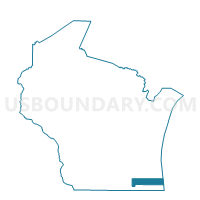
Outline

Summary
| Unique Area Identifier | 696402 |
| Name | BURLINGTON - T 9 Voting District |
| County | Racine County |
| State | Wisconsin |
| Area (square miles) | 3.04 |
| Land Area (square miles) | 2.98 |
| Water Area (square miles) | 0.06 |
| % of Land Area | 98.02 |
| % of Water Area | 1.98 |
| Latitude of the Internal Point | 42.63148440 |
| Longtitude of the Internal Point | -88.29912100 |
Maps


Graphs
Select a template below for downloading or customizing gragh for BURLINGTON - T 9 Voting District, Racine County, Wisconsin


Neighbors
Neighoring Voting District (by Name) Neighboring Voting District on the Map
- Burlington - C 10 Voting District, Racine County, WI
- Burlington - C 13 Voting District, Racine County, WI
- Burlington - C 5 Voting District, Racine County, WI
- BURLINGTON - T 10 Voting District, Racine County, WI
- BURLINGTON - T 11 Voting District, Racine County, WI
- BURLINGTON - T 12 Voting District, Racine County, WI
- BURLINGTON - T 8 Voting District, Racine County, WI
- LYONS - T 2 Voting District, Walworth County, WI
- SPRING PRAIRIE - T 3 Voting District, Walworth County, WI
- SPRING PRAIRIE - T 4 Voting District, Walworth County, WI
- WHEATLAND - T5 Voting District, Kenosha County, WI
Top 10 Neighboring County Subdivision (by Population) Neighboring County Subdivision on the Map
- Burlington city, Racine County, WI (10,464)
- Burlington town, Racine County, WI (6,502)
- Lyons town, Walworth County, WI (3,698)
- Wheatland town, Kenosha County, WI (3,373)
- Spring Prairie town, Walworth County, WI (2,181)
Top 10 Neighboring Place (by Population) Neighboring Place on the Map
Top 10 Neighboring Elementary School District (by Population) Neighboring Elementary School District on the Map
Top 10 Neighboring Secondary School District (by Population) Neighboring Secondary School District on the Map
Top 10 Neighboring Unified School District (by Population) Neighboring Unified School District on the Map
Top 10 Neighboring State Legislative District Lower Chamber (by Population) Neighboring State Legislative District Lower Chamber on the Map
- Assembly District 31, WI (61,767)
- Assembly District 66, WI (61,567)
- Assembly District 32, WI (60,152)
Top 10 Neighboring State Legislative District Upper Chamber (by Population) Neighboring State Legislative District Upper Chamber on the Map
Top 10 Neighboring 111th Congressional District (by Population) Neighboring 111th Congressional District on the Map
Top 10 Neighboring Census Tract (by Population) Neighboring Census Tract on the Map
- Census Tract 2, Walworth County, WI (6,556)
- Census Tract 28, Kenosha County, WI (6,335)
- Census Tract 26, Racine County, WI (5,739)
- Census Tract 24.01, Racine County, WI (5,727)
- Census Tract 10, Walworth County, WI (5,241)