


REID - T 1 Voting District, Marathon County, Wisconsin
About
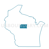
Outline

Summary
| Unique Area Identifier | 694878 |
| Name | REID - T 1 Voting District |
| County | Marathon County |
| State | Wisconsin |
| Area (square miles) | 9.34 |
| Land Area (square miles) | 8.78 |
| Water Area (square miles) | 0.56 |
| % of Land Area | 94.02 |
| % of Water Area | 5.98 |
| Latitude of the Internal Point | 44.80712440 |
| Longtitude of the Internal Point | -89.36180520 |
Maps


Graphs
Select a template below for downloading or customizing gragh for REID - T 1 Voting District, Marathon County, Wisconsin


Neighbors
Neighoring Voting District (by Name) Neighboring Voting District on the Map
- BEVENT - T 1 Voting District, Marathon County, WI
- BEVENT - T 2 Voting District, Marathon County, WI
- ELDERON - T 1 Voting District, Marathon County, WI
- FRANZEN - T 1 Voting District, Marathon County, WI
- NORRIE - T 1 Voting District, Marathon County, WI
- REID - T 2 Voting District, Marathon County, WI
- RINGLE - T 1 Voting District, Marathon County, WI
Top 10 Neighboring County Subdivision (by Population) Neighboring County Subdivision on the Map
- Ringle town, Marathon County, WI (1,711)
- Reid town, Marathon County, WI (1,215)
- Bevent town, Marathon County, WI (1,118)
- Norrie town, Marathon County, WI (976)
- Elderon town, Marathon County, WI (606)
- Franzen town, Marathon County, WI (578)
Top 10 Neighboring Unified School District (by Population) Neighboring Unified School District on the Map
- D.C. Everest Area School District, WI (33,511)
- Mosinee School District, WI (12,046)
- Wittenberg-Birnamwood School District, WI (7,837)
Top 10 Neighboring State Legislative District Lower Chamber (by Population) Neighboring State Legislative District Lower Chamber on the Map
- Assembly District 86, WI (59,763)
- Assembly District 85, WI (54,840)
- Assembly District 36, WI (50,804)