


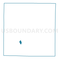
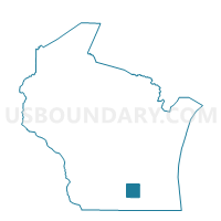
Fort Atkinson - C 1 Voting District, Jefferson County, Wisconsin
About
Outline

Summary
| Unique Area Identifier | 694231 |
| Name | Fort Atkinson - C 1 Voting District |
| County | Jefferson County |
| State | Wisconsin |
| Area (square miles) | 0.78 |
| Land Area (square miles) | 0.77 |
| Water Area (square miles) | 0.01 |
| % of Land Area | 98.96 |
| % of Water Area | 1.04 |
| Latitude of the Internal Point | 42.93642730 |
| Longtitude of the Internal Point | -88.85750110 |
Maps

Graphs
Select a template below for downloading or customizing gragh for Fort Atkinson - C 1 Voting District, Jefferson County, Wisconsin


Neighbors
Neighoring Voting District (by Name) Neighboring Voting District on the Map
- Fort Atkinson - C 2 Voting District, Jefferson County, WI
- Fort Atkinson - C 3 Voting District, Jefferson County, WI
- Fort Atkinson - C 4 Voting District, Jefferson County, WI
- Fort Atkinson - C 5 Voting District, Jefferson County, WI
- KOSHKONONG - T 4 Voting District, Jefferson County, WI
- KOSHKONONG - T 5 Voting District, Jefferson County, WI