


Voting District 11, Tyler County, West Virginia
About
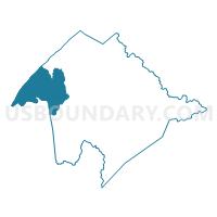
Outline

Summary
| Unique Area Identifier | 691938 |
| Name | Voting District 11 |
| County | Tyler County |
| State | West Virginia |
| Area (square miles) | 26.35 |
| Land Area (square miles) | 24.61 |
| Water Area (square miles) | 1.74 |
| % of Land Area | 93.40 |
| % of Water Area | 6.60 |
| Latitude of the Internal Point | 39.49264330 |
| Longtitude of the Internal Point | -81.04103400 |
Maps


Graphs
Select a template below for downloading or customizing gragh for Voting District 11, Tyler County, West Virginia


Neighbors
Neighoring Voting District (by Name) Neighboring Voting District on the Map
- Voting District 2, Tyler County, WV
- Voting District 4, Tyler County, WV
- Voting District 5, Tyler County, WV
- Voting District 6 PRT, Pleasants County, WV
- Voting District 7 Arvilla, Pleasants County, WV
- Voting District 9, Tyler County, WV
- GRANDVIEW Voting District, Washington County, OH
- MATAMORAS Voting District, Washington County, OH
Top 10 Neighboring County Subdivision (by Population) Neighboring County Subdivision on the Map
- Central district, Tyler County, WV (2,408)
- South district, Tyler County, WV (2,381)
- District D, Pleasants County, WV (2,342)
- North district, Tyler County, WV (2,285)
- West district, Tyler County, WV (2,134)
- Grandview township, Washington County, OH (1,731)
Top 10 Neighboring Place (by Population) Neighboring Place on the Map
Top 10 Neighboring Unified School District (by Population) Neighboring Unified School District on the Map
- Tyler County School District, WV (9,208)
- Pleasants County School District, WV (7,605)
- Frontier Local School District, OH (5,241)
Top 10 Neighboring State Legislative District Lower Chamber (by Population) Neighboring State Legislative District Lower Chamber on the Map
- State House District 93, OH (116,725)
- State House District 6, WV (18,363)
- State House District 7, WV (18,054)
Top 10 Neighboring State Legislative District Upper Chamber (by Population) Neighboring State Legislative District Upper Chamber on the Map
- State Senate District 20, OH (357,708)
- State Senate District 3, WV (109,227)
- State Senate District 2, WV (101,327)
Top 10 Neighboring 111th Congressional District (by Population) Neighboring 111th Congressional District on the Map
Top 10 Neighboring Census Tract (by Population) Neighboring Census Tract on the Map
- Census Tract 212, Washington County, OH (5,777)
- Census Tract 9619, Tyler County, WV (3,808)
- Census Tract 9621, Pleasants County, WV (3,449)
- Census Tract 9618, Tyler County, WV (3,257)
- Census Tract 9620, Tyler County, WV (2,143)