


Voting District 100, Ohio County, West Virginia
About
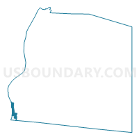
Outline

Summary
| Unique Area Identifier | 691616 |
| Name | Voting District 100 |
| County | Ohio County |
| State | West Virginia |
| Area (square miles) | 0.36 |
| Land Area (square miles) | 0.12 |
| Water Area (square miles) | 0.24 |
| % of Land Area | 32.64 |
| % of Water Area | 67.36 |
| Latitude of the Internal Point | 40.04208840 |
| Longtitude of the Internal Point | -80.72601710 |
Maps


Graphs
Select a template below for downloading or customizing gragh for Voting District 100, Ohio County, West Virginia


Neighbors
Neighoring Voting District (by Name) Neighboring Voting District on the Map
- Voting District 102, Ohio County, WV
- Voting District 103, Ohio County, WV
- Voting District 104, Ohio County, WV
- Voting District 20, Marshall County, WV
- Voting District 69, Ohio County, WV
- Voting District 77, Ohio County, WV
- Voting District BELLAIRE VILLAGE 3, Belmont County, OH
- Voting District BOYDSVILLE, Belmont County, OH
- Voting District PULTNEY TWP 1, Belmont County, OH
Top 10 Neighboring County Subdivision (by Population) Neighboring County Subdivision on the Map
- District 3, Ohio County, WV (15,243)
- Pease township, Belmont County, OH (14,309)
- District 2, Ohio County, WV (12,448)
- District 1, Marshall County, WV (10,892)
- Pultney township, Belmont County, OH (8,795)
Top 10 Neighboring Place (by Population) Neighboring Place on the Map
Top 10 Neighboring Unified School District (by Population) Neighboring Unified School District on the Map
- Ohio County School District, WV (44,443)
- Marshall County School District, WV (33,107)
- Bellaire Local School District, OH (9,932)
- Bridgeport Exempted Village School District, OH (6,641)
Top 10 Neighboring State Legislative District Lower Chamber (by Population) Neighboring State Legislative District Lower Chamber on the Map
- State House District 95, OH (106,820)
- State House District 4, WV (33,317)
- State House District 3, WV (31,628)
Top 10 Neighboring State Legislative District Upper Chamber (by Population) Neighboring State Legislative District Upper Chamber on the Map
- State Senate District 30, OH (338,710)
- State Senate District 2, WV (101,327)
- State Senate District 1, WV (95,975)
Top 10 Neighboring 111th Congressional District (by Population) Neighboring 111th Congressional District on the Map
Top 10 Neighboring Census Tract (by Population) Neighboring Census Tract on the Map
- Census Tract 114, Belmont County, OH (4,499)
- Census Tract 213, Marshall County, WV (4,454)
- Census Tract 102, Belmont County, OH (3,905)
- Census Tract 26, Ohio County, WV (2,240)
- Census Tract 117, Belmont County, OH (1,406)
- Census Tract 13, Ohio County, WV (1,405)
- Census Tract 205, Marshall County, WV (1,132)
- Census Tract 6, Ohio County, WV (1,100)