


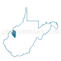
Voting District 5, Jackson County, West Virginia
About
Outline

Summary
| Unique Area Identifier | 690848 |
| Name | Voting District 5 |
| County | Jackson County |
| State | West Virginia |
| Area (square miles) | 37.16 |
| Land Area (square miles) | 36.69 |
| Water Area (square miles) | 0.47 |
| % of Land Area | 98.72 |
| % of Water Area | 1.28 |
| Latitude of the Internal Point | 39.01070380 |
| Longtitude of the Internal Point | -81.70121110 |
Maps


Graphs
Select a template below for downloading or customizing gragh for Voting District 5, Jackson County, West Virginia


Neighbors
Neighoring Voting District (by Name) Neighboring Voting District on the Map
- Voting District 1, Jackson County, WV
- Voting District 10, Jackson County, WV
- Voting District 4, Jackson County, WV
- Voting District 6, Jackson County, WV
- Voting District 82, Wood County, WV
- Voting District 84, Wood County, WV
- LEBANON Voting District, Meigs County, OH
Top 10 Neighboring County Subdivision (by Population) Neighboring County Subdivision on the Map
- Northern district, Jackson County, WV (8,753)
- Harris district, Wood County, WV (1,820)
- Steele district, Wood County, WV (1,373)
- Lebanon township, Meigs County, OH (967)
Top 10 Neighboring Unified School District (by Population) Neighboring Unified School District on the Map
- Wood County School District, WV (86,956)
- Jackson County School District, WV (29,211)
- Southern Local School District, OH (4,736)
Top 10 Neighboring State Legislative District Lower Chamber (by Population) Neighboring State Legislative District Lower Chamber on the Map
- State House District 92, OH (123,037)
- State House District 12, WV (20,112)
- State House District 9, WV (19,202)
Top 10 Neighboring State Legislative District Upper Chamber (by Population) Neighboring State Legislative District Upper Chamber on the Map
- State Senate District 20, OH (357,708)
- State Senate District 4, WV (117,998)
- State Senate District 3, WV (109,227)
Top 10 Neighboring 111th Congressional District (by Population) Neighboring 111th Congressional District on the Map
- Congressional District 2, WV (648,186)
- Congressional District 6, OH (623,742)
- Congressional District 1, WV (615,991)
Top 10 Neighboring Census Tract (by Population) Neighboring Census Tract on the Map
- Census Tract 9633, Jackson County, WV (4,698)
- Census Tract 9632, Jackson County, WV (4,620)
- Census Tract 9646, Meigs County, OH (3,332)
- Census Tract 108, Wood County, WV (3,153)