


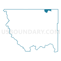
Molson Voting District, Okanogan County, Washington
About
Outline

Summary
| Unique Area Identifier | 687784 |
| Name | Molson Voting District |
| County | Okanogan County |
| State | Washington |
| Area (square miles) | 37.76 |
| Land Area (square miles) | 37.52 |
| Water Area (square miles) | 0.24 |
| % of Land Area | 99.37 |
| % of Water Area | 0.63 |
| Latitude of the Internal Point | 48.96484910 |
| Longtitude of the Internal Point | -119.25955870 |
Maps


Graphs
Select a template below for downloading or customizing gragh for Molson Voting District, Okanogan County, Washington


Neighbors
Neighoring Voting District (by Name) Neighboring Voting District on the Map
- Chesaw Voting District, Okanogan County, WA
- Eder Voting District, Okanogan County, WA
- Kipling Voting District, Okanogan County, WA
- Teal Lake Voting District, Okanogan County, WA
- Tonasket Creek Voting District, Okanogan County, WA