


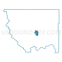
Spring Coulee Voting District, Okanogan County, Washington
About
Outline

Summary
| Unique Area Identifier | 687764 |
| Name | Spring Coulee Voting District |
| County | Okanogan County |
| State | Washington |
| Area (square miles) | 36.07 |
| Land Area (square miles) | 35.93 |
| Water Area (square miles) | 0.14 |
| % of Land Area | 99.61 |
| % of Water Area | 0.39 |
| Latitude of the Internal Point | 48.43175830 |
| Longtitude of the Internal Point | -119.67473180 |
Maps


Graphs
Select a template below for downloading or customizing gragh for Spring Coulee Voting District, Okanogan County, Washington


Neighbors
Neighoring Voting District (by Name) Neighboring Voting District on the Map
- Boston Voting District, Okanogan County, WA
- Fletcher Voting District, Okanogan County, WA
- Glover Voting District, Okanogan County, WA
- Hudson Voting District, Okanogan County, WA
- Pogue Voting District, Okanogan County, WA