


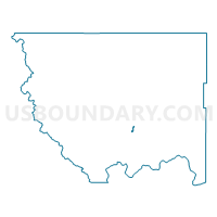
Mock Voting District, Okanogan County, Washington
About
Outline

Summary
| Unique Area Identifier | 687747 |
| Name | Mock Voting District |
| County | Okanogan County |
| State | Washington |
| Area (square miles) | 0.74 |
| Land Area (square miles) | 0.68 |
| Water Area (square miles) | 0.06 |
| % of Land Area | 92.11 |
| % of Water Area | 7.89 |
| Latitude of the Internal Point | 48.32198140 |
| Longtitude of the Internal Point | -119.61443210 |
Maps


Graphs
Select a template below for downloading or customizing gragh for Mock Voting District, Okanogan County, Washington


Neighbors
Neighoring Voting District (by Name) Neighboring Voting District on the Map
- Alma Voting District, Okanogan County, WA
- Boston Voting District, Okanogan County, WA
- Fletcher Voting District, Okanogan County, WA
- Okanogan 12 Voting District, Okanogan County, WA
- Okanogan 2 Voting District, Okanogan County, WA
- Okanogan 5 Voting District, Okanogan County, WA
- Okanogan Rural Voting District, Okanogan County, WA