


Water: Possession Sound, Island County, Washington
About
Outline

Summary
| Unique Area Identifier | 684502 |
| Name | Water: Possession Sound |
| County | Island County |
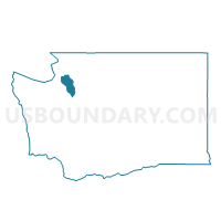
| State | Washington |
| Area (square miles) | 5.26 |
| Land Area (square miles) | 0.00 |
| Water Area (square miles) | 5.26 |
| % of Land Area | 0.00 |
| % of Water Area | 100.00 |
| Latitude of the Internal Point | 47.92969720 |
| Longtitude of the Internal Point | -122.34980020 |
Maps


Graphs
Select a template below for downloading or customizing gragh for Water: Possession Sound, Island County, Washington


Neighbors
Neighoring Voting District (by Name) Neighboring Voting District on the Map
- Clinton Voting District, Island County, WA
- Possession Voting District, Island County, WA
- Water: Possession Sound, Snohomish County, WA
- Water: Possession Sound - City of Mukilteo, Snohomish County, WA
- Water: Puget Sound, Island County, WA
- Water: Puget Sound Leg 21, Snohomish County, WA
- Water: Saratoga Passage, Island County, WA
Top 10 Neighboring County Subdivision (by Population) Neighboring County Subdivision on the Map
- Edmonds CCD, Snohomish County, WA (234,501)
- Everett CCD, Snohomish County, WA (171,501)
- South Whidbey Island CCD, Island County, WA (13,630)
Top 10 Neighboring Place (by Population) Neighboring Place on the Map
Top 10 Neighboring Unified School District (by Population) Neighboring Unified School District on the Map
Top 10 Neighboring State Legislative District Lower Chamber (by Population) Neighboring State Legislative District Lower Chamber on the Map
- State House District 10, WA (134,117)
- State House District 21, WA (133,156)
- State House District 38, WA (129,624)
Top 10 Neighboring State Legislative District Upper Chamber (by Population) Neighboring State Legislative District Upper Chamber on the Map
- State Senate District 10, WA (134,117)
- State Senate District 21, WA (133,156)
- State Senate District 38, WA (129,624)
Top 10 Neighboring 111th Congressional District (by Population) Neighboring 111th Congressional District on the Map
Top 10 Neighboring Census Tract (by Population) Neighboring Census Tract on the Map
- Census Tract 9720, Island County, WA (3,938)
- Census Tract 9721, Island County, WA (3,490)
- Census Tract 9922.01, Island County, WA (0)
- Census Tract 9900.02, Snohomish County, WA (0)