


Voting District 209, Douglas County, Washington
About
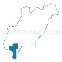
Outline

Summary
| Unique Area Identifier | 684111 |
| Name | Voting District 209 |
| County | Douglas County |
| State | Washington |
| Area (square miles) | 101.96 |
| Land Area (square miles) | 99.00 |
| Water Area (square miles) | 2.96 |
| % of Land Area | 97.10 |
| % of Water Area | 2.90 |
| Latitude of the Internal Point | 47.36333270 |
| Longtitude of the Internal Point | -120.03885850 |
Maps


Graphs
Select a template below for downloading or customizing gragh for Voting District 209, Douglas County, Washington


Neighbors
Neighoring Voting District (by Name) Neighboring Voting District on the Map
- Voting District 145, Chelan County, WA
- Voting District 147, Chelan County, WA
- Voting District 204, Douglas County, WA
- Voting District 206, Douglas County, WA
- Voting District 210, Douglas County, WA
- Voting District 211, Douglas County, WA
- Voting District 313, Douglas County, WA
- Voting District 319, Douglas County, WA
- Northeast Fairview Voting District, Kittitas County, WA
- Quincy Rural North Voting District, Grant County, WA
- Quincy Rural South Voting District, Grant County, WA
- Water: Columbia River, Grant County, WA
Top 10 Neighboring County Subdivision (by Population) Neighboring County Subdivision on the Map
- East Wenatchee CCD, Douglas County, WA (29,708)
- Quincy CCD, Grant County, WA (9,811)
- Northeast Kittitas CCD, Kittitas County, WA (4,359)
- Malaga CCD, Chelan County, WA (3,762)
- Waterville CCD, Douglas County, WA (2,224)
Top 10 Neighboring Place (by Population) Neighboring Place on the Map
Top 10 Neighboring Unified School District (by Population) Neighboring Unified School District on the Map
- Wenatchee School District, WA (42,698)
- Eastmont School District, WA (29,884)
- Quincy School District, WA (11,750)
- Kittitas School District, WA (3,673)
- Waterville School District, WA (1,659)
- Palisades School District, WA (269)
Top 10 Neighboring State Legislative District Lower Chamber (by Population) Neighboring State Legislative District Lower Chamber on the Map
Top 10 Neighboring State Legislative District Upper Chamber (by Population) Neighboring State Legislative District Upper Chamber on the Map
Top 10 Neighboring 111th Congressional District (by Population) Neighboring 111th Congressional District on the Map
Top 10 Neighboring Census Tract (by Population) Neighboring Census Tract on the Map
- Census Tract 9503, Douglas County, WA (6,057)
- Census Tract 9753, Kittitas County, WA (4,359)
- Census Tract 9612, Chelan County, WA (3,762)
- Census Tract 105, Grant County, WA (2,963)
- Census Tract 9502, Douglas County, WA (2,224)
Top 10 Neighboring 5-Digit ZIP Code Tabulation Area (by Population) Neighboring 5-Digit ZIP Code Tabulation Area on the Map
- 98802, WA (28,719)
- 98848, WA (11,518)
- 98828, WA (2,146)
- 98850, WA (1,543)
- 98858, WA (1,521)
- 98845, WA (128)