


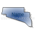
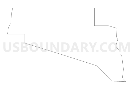
Macleay Voting District, Clallam County, Washington
About
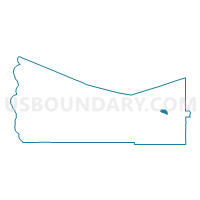
Outline

Summary
| Unique Area Identifier | 683743 |
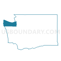
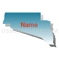
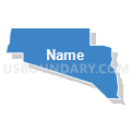
| Name | Macleay Voting District |
| County | Clallam County |
| State | Washington |
| Area (square miles) | 4.03 |
| Land Area (square miles) | 4.03 |
| Water Area (square miles) | 0.00 |
| % of Land Area | 100.00 |
| % of Water Area | 0.00 |
| Latitude of the Internal Point | 48.10432800 |
| Longtitude of the Internal Point | -123.18225320 |
Maps

Graphs
Select a template below for downloading or customizing gragh for Macleay Voting District, Clallam County, Washington


Neighbors
Neighoring Voting District (by Name) Neighboring Voting District on the Map
- Agnew Voting District, Clallam County, WA
- Carlsborg Voting District, Clallam County, WA
- Cline Voting District, Clallam County, WA
- Coyote Voting District, Clallam County, WA
- Eagle Voting District, Clallam County, WA
- Elk Voting District, Clallam County, WA
- Monterra Voting District, Clallam County, WA
- Prairie North Voting District, Clallam County, WA
- Robin Hill Voting District, Clallam County, WA
Top 10 Neighboring County Subdivision (by Population) Neighboring County Subdivision on the Map
Top 10 Neighboring Place (by Population) Neighboring Place on the Map
Top 10 Neighboring Unified School District (by Population) Neighboring Unified School District on the Map
Top 10 Neighboring State Legislative District Lower Chamber (by Population) Neighboring State Legislative District Lower Chamber on the Map
Top 10 Neighboring State Legislative District Upper Chamber (by Population) Neighboring State Legislative District Upper Chamber on the Map
Top 10 Neighboring 111th Congressional District (by Population) Neighboring 111th Congressional District on the Map
Top 10 Neighboring Census Tract (by Population) Neighboring Census Tract on the Map
- Census Tract 19, Clallam County, WA (5,693)
- Census Tract 17, Clallam County, WA (4,670)
- Census Tract 16, Clallam County, WA (3,164)