


Ward C, Waynesboro city, Virginia
About
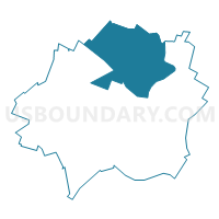
Outline

Summary
| Unique Area Identifier | 683333 |
| Name | Ward C |
| County | Waynesboro city |
| State | Virginia |
| Area (square miles) | 2.75 |
| Land Area (square miles) | 2.72 |
| Water Area (square miles) | 0.02 |
| % of Land Area | 99.23 |
| % of Water Area | 0.77 |
| Latitude of the Internal Point | 38.09099130 |
| Longtitude of the Internal Point | -78.89283880 |
Maps


Graphs
Select a template below for downloading or customizing gragh for Ward C, Waynesboro city, Virginia


Neighbors
Neighoring Voting District (by Name) Neighboring Voting District on the Map
- Dooms Voting District, Augusta County, VA
- Fishersville Voting District, Augusta County, VA
- Ward A, Waynesboro city, VA
- Ward B, Waynesboro city, VA
- Ward D, Waynesboro city, VA
Top 10 Neighboring County Subdivision (by Population) Neighboring County Subdivision on the Map
Top 10 Neighboring Place (by Population) Neighboring Place on the Map
Top 10 Neighboring Unified School District (by Population) Neighboring Unified School District on the Map
Top 10 Neighboring State Legislative District Lower Chamber (by Population) Neighboring State Legislative District Lower Chamber on the Map
Top 10 Neighboring State Legislative District Upper Chamber (by Population) Neighboring State Legislative District Upper Chamber on the Map
Top 10 Neighboring 111th Congressional District (by Population) Neighboring 111th Congressional District on the Map
Top 10 Neighboring Census Tract (by Population) Neighboring Census Tract on the Map
- Census Tract 706, Augusta County, VA (9,218)
- Census Tract 34, Waynesboro city, VA (5,365)
- Census Tract 705, Augusta County, VA (5,240)
- Census Tract 32, Waynesboro city, VA (5,240)
- Census Tract 35, Waynesboro city, VA (4,646)
- Census Tract 33, Waynesboro city, VA (4,538)
- Census Tract 31, Waynesboro city, VA (1,217)