


Shell Voting District, Virginia Beach city, Virginia
About
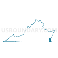
Outline

Summary
| Unique Area Identifier | 683326 |
| Name | Shell Voting District |
| County | Virginia Beach city |
| State | Virginia |
| Area (square miles) | 1.24 |
| Land Area (square miles) | 1.13 |
| Water Area (square miles) | 0.12 |
| % of Land Area | 90.64 |
| % of Water Area | 9.36 |
| Latitude of the Internal Point | 36.87994110 |
| Longtitude of the Internal Point | -76.17671710 |
Maps


Graphs
Select a template below for downloading or customizing gragh for Shell Voting District, Virginia Beach city, Virginia


Neighbors
Neighoring Voting District (by Name) Neighboring Voting District on the Map
- Baker Voting District, Virginia Beach city, VA
- Barron Black Voting District, Norfolk city, VA
- Bayside Voting District, Virginia Beach city, VA
- Davis Corner Voting District, Virginia Beach city, VA
- Fairlawn Voting District, Norfolk city, VA
- Hagood Voting District, Virginia Beach city, VA
- Newtown Voting District, Virginia Beach city, VA
Top 10 Neighboring County Subdivision (by Population) Neighboring County Subdivision on the Map
Top 10 Neighboring Place (by Population) Neighboring Place on the Map
Top 10 Neighboring Unified School District (by Population) Neighboring Unified School District on the Map
Top 10 Neighboring State Legislative District Lower Chamber (by Population) Neighboring State Legislative District Lower Chamber on the Map
Top 10 Neighboring State Legislative District Upper Chamber (by Population) Neighboring State Legislative District Upper Chamber on the Map
- State Senate District 5, VA (201,347)
- State Senate District 7, VA (177,786)
- State Senate District 6, VA (152,346)
Top 10 Neighboring 111th Congressional District (by Population) Neighboring 111th Congressional District on the Map
Top 10 Neighboring Census Tract (by Population) Neighboring Census Tract on the Map
- Census Tract 404.02, Virginia Beach city, VA (6,995)
- Census Tract 404.04, Virginia Beach city, VA (6,718)
- Census Tract 402, Virginia Beach city, VA (5,283)
- Census Tract 404.03, Virginia Beach city, VA (3,810)
- Census Tract 68, Norfolk city, VA (1,765)
- Census Tract 9803, Norfolk city, VA (1)