


Pounding Mill Voting District, Tazewell County, Virginia
About
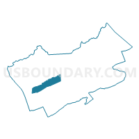
Outline

Summary
| Unique Area Identifier | 682657 |
| Name | Pounding Mill Voting District |
| County | Tazewell County |
| State | Virginia |
| Area (square miles) | 15.31 |
| Land Area (square miles) | 15.24 |
| Water Area (square miles) | 0.07 |
| % of Land Area | 99.53 |
| % of Water Area | 0.47 |
| Latitude of the Internal Point | 37.08252300 |
| Longtitude of the Internal Point | -81.66666620 |
Maps


Graphs
Select a template below for downloading or customizing gragh for Pounding Mill Voting District, Tazewell County, Virginia


Neighbors
Neighoring Voting District (by Name) Neighboring Voting District on the Map
- Baptist Valley Voting District, Tazewell County, VA
- Cedar Bluff Voting District, Tazewell County, VA
- Gap Store Voting District, Tazewell County, VA
- Jeffersonville Voting District, Tazewell County, VA
- Wardell Voting District, Tazewell County, VA
Top 10 Neighboring County Subdivision (by Population) Neighboring County Subdivision on the Map
- Northern district, Tazewell County, VA (9,243)
- Southern district, Tazewell County, VA (9,101)
- Western district, Tazewell County, VA (8,841)
Top 10 Neighboring Place (by Population) Neighboring Place on the Map
Top 10 Neighboring Unified School District (by Population) Neighboring Unified School District on the Map
Top 10 Neighboring State Legislative District Lower Chamber (by Population) Neighboring State Legislative District Lower Chamber on the Map
Top 10 Neighboring State Legislative District Upper Chamber (by Population) Neighboring State Legislative District Upper Chamber on the Map
Top 10 Neighboring 111th Congressional District (by Population) Neighboring 111th Congressional District on the Map
Top 10 Neighboring Census Tract (by Population) Neighboring Census Tract on the Map
- Census Tract 203, Tazewell County, VA (6,701)
- Census Tract 204, Tazewell County, VA (4,385)
- Census Tract 206, Tazewell County, VA (4,358)
- Census Tract 210, Tazewell County, VA (4,234)