


Carsley Voting District, Surry County, Virginia
About
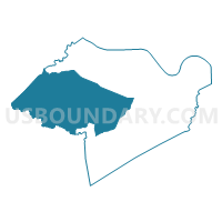
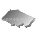
Outline

Summary
| Unique Area Identifier | 682621 |
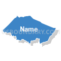
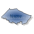
| Name | Carsley Voting District |
| County | Surry County |
| State | Virginia |
| Area (square miles) | 94.68 |
| Land Area (square miles) | 94.33 |
| Water Area (square miles) | 0.35 |
| % of Land Area | 99.63 |
| % of Water Area | 0.37 |
| Latitude of the Internal Point | 37.12019660 |
| Longtitude of the Internal Point | -76.99971110 |
Maps


Graphs
Select a template below for downloading or customizing gragh for Carsley Voting District, Surry County, Virginia


Neighbors
Neighoring Voting District (by Name) Neighboring Voting District on the Map
- Blackwater Voting District, Sussex County, VA
- Brandon Voting District, Prince George County, VA
- Claremont Voting District, Surry County, VA
- Dendron Voting District, Surry County, VA
- Harrison Voting District, Prince George County, VA
- Spring Grove Voting District, Surry County, VA
- Surry Voting District, Surry County, VA
- Wall's Bridge Voting District, Surry County, VA
Top 10 Neighboring County Subdivision (by Population) Neighboring County Subdivision on the Map
- Blackwater district, Prince George County, VA (3,974)
- Waverly district, Sussex County, VA (2,924)
- Claremont district, Surry County, VA (1,447)
- Surry district, Surry County, VA (1,423)
- Carsley district, Surry County, VA (1,375)
- Dendron district, Surry County, VA (1,370)
- Brandon district, Prince George County, VA (1,361)
Top 10 Neighboring Place (by Population) Neighboring Place on the Map
Top 10 Neighboring Unified School District (by Population) Neighboring Unified School District on the Map
- Prince George County Public Schools, VA (35,725)
- Sussex County Public Schools, VA (12,087)
- Surry County Public Schools, VA (7,058)
Top 10 Neighboring State Legislative District Lower Chamber (by Population) Neighboring State Legislative District Lower Chamber on the Map
- State House District 64, VA (83,940)
- State House District 62, VA (76,461)
- State House District 75, VA (70,454)
Top 10 Neighboring State Legislative District Upper Chamber (by Population) Neighboring State Legislative District Upper Chamber on the Map
Top 10 Neighboring 111th Congressional District (by Population) Neighboring 111th Congressional District on the Map
Top 10 Neighboring Census Tract (by Population) Neighboring Census Tract on the Map
- Census Tract 8504, Prince George County, VA (5,182)
- Census Tract 8602, Surry County, VA (3,651)
- Census Tract 8601, Surry County, VA (3,407)
- Census Tract 8703, Sussex County, VA (2,861)