


Stony Run Voting District, Rockingham County, Virginia
About
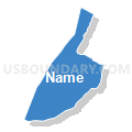
Outline

Summary
| Unique Area Identifier | 682491 |
| Name | Stony Run Voting District |
| County | Rockingham County |
| State | Virginia |
| Area (square miles) | 27.09 |
| Land Area (square miles) | 27.05 |
| Water Area (square miles) | 0.05 |
| % of Land Area | 99.83 |
| % of Water Area | 0.17 |
| Latitude of the Internal Point | 38.42136880 |
| Longtitude of the Internal Point | -78.71676170 |
Maps


Graphs
Select a template below for downloading or customizing gragh for Stony Run Voting District, Rockingham County, Virginia


Neighbors
Neighoring Voting District (by Name) Neighboring Voting District on the Map
- Cross Keys Voting District, Rockingham County, VA
- Keezletown Voting District, Rockingham County, VA
- McGaheysville Voting District, Rockingham County, VA
- Melrose Voting District, Rockingham County, VA
- Shenandoah Voting District, Page County, VA
- South Fork Voting District, Rockingham County, VA
- Tenth Legion Voting District, Rockingham County, VA
Top 10 Neighboring County Subdivision (by Population) Neighboring County Subdivision on the Map
- Stonewall district, Rockingham County, VA (19,472)
- Plains district, Rockingham County, VA (14,628)
- Central district, Rockingham County, VA (12,774)
- District 5, Shenandoah, Page County, VA (5,021)
Top 10 Neighboring Place (by Population) Neighboring Place on the Map
Top 10 Neighboring Unified School District (by Population) Neighboring Unified School District on the Map
Top 10 Neighboring State Legislative District Lower Chamber (by Population) Neighboring State Legislative District Lower Chamber on the Map
- State House District 25, VA (83,601)
- State House District 26, VA (82,704)
- State House District 15, VA (78,102)
Top 10 Neighboring State Legislative District Upper Chamber (by Population) Neighboring State Legislative District Upper Chamber on the Map
Top 10 Neighboring 111th Congressional District (by Population) Neighboring 111th Congressional District on the Map
Top 10 Neighboring Census Tract (by Population) Neighboring Census Tract on the Map
- Census Tract 305, Page County, VA (5,957)
- Census Tract 103, Rockingham County, VA (4,813)
- Census Tract 119, Rockingham County, VA (3,006)
- Census Tract 104, Rockingham County, VA (2,531)
- Census Tract 105, Rockingham County, VA (2,356)
Top 10 Neighboring 5-Digit ZIP Code Tabulation Area (by Population) Neighboring 5-Digit ZIP Code Tabulation Area on the Map
- 22802, VA (26,293)
- 22827, VA (10,388)
- 22849, VA (5,044)
- 22840, VA (4,354)
- 22846, VA (1,855)
- 22832, VA (1,091)