


Hampden Voting District, Prince Edward County, Virginia
About
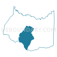
Outline

Summary
| Unique Area Identifier | 682303 |
| Name | Hampden Voting District |
| County | Prince Edward County |
| State | Virginia |
| Area (square miles) | 52.34 |
| Land Area (square miles) | 51.00 |
| Water Area (square miles) | 1.33 |
| % of Land Area | 97.45 |
| % of Water Area | 2.55 |
| Latitude of the Internal Point | 37.17800750 |
| Longtitude of the Internal Point | -78.47625800 |
Maps


Graphs
Select a template below for downloading or customizing gragh for Hampden Voting District, Prince Edward County, Virginia


Neighbors
Neighoring Voting District (by Name) Neighboring Voting District on the Map
- Buffalo Heights Voting District, Prince Edward County, VA
- County Seat Voting District, Charlotte County, VA
- Cullen Voting District, Charlotte County, VA
- Darlington Heights Voting District, Prince Edward County, VA
- Farmville Voting District, Prince Edward County, VA
- Keysville Voting District, Charlotte County, VA
- Leigh Voting District, Prince Edward County, VA
- Lockett Voting District, Prince Edward County, VA
- Mt. Pleasant Voting District, Prince Edward County, VA
Top 10 Neighboring County Subdivision (by Population) Neighboring County Subdivision on the Map
- District 101, Prince Edward County, VA (5,247)
- District 401, Prince Edward County, VA (3,031)
- District 301, Prince Edward County, VA (2,933)
- Walton district, Charlotte County, VA (2,781)
- District 201, Prince Edward County, VA (2,748)
- District 501, Prince Edward County, VA (2,722)
- Madison district, Charlotte County, VA (2,693)
Top 10 Neighboring Place (by Population) Neighboring Place on the Map
Top 10 Neighboring Unified School District (by Population) Neighboring Unified School District on the Map
Top 10 Neighboring State Legislative District Lower Chamber (by Population) Neighboring State Legislative District Lower Chamber on the Map
Top 10 Neighboring State Legislative District Upper Chamber (by Population) Neighboring State Legislative District Upper Chamber on the Map
Top 10 Neighboring 111th Congressional District (by Population) Neighboring 111th Congressional District on the Map
Top 10 Neighboring Census Tract (by Population) Neighboring Census Tract on the Map
- Census Tract 9303, Prince Edward County, VA (7,053)
- Census Tract 9301, Prince Edward County, VA (6,679)
- Census Tract 9301, Charlotte County, VA (6,032)
- Census Tract 9302.02, Prince Edward County, VA (3,571)
Top 10 Neighboring 5-Digit ZIP Code Tabulation Area (by Population) Neighboring 5-Digit ZIP Code Tabulation Area on the Map
- 23901, VA (16,399)
- 23947, VA (4,293)
- 23923, VA (2,592)
- 23954, VA (2,017)
- 23934, VA (681)
- 23943, VA (225)