


Eltham Voting District, New Kent County, Virginia
About
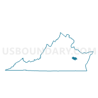
Outline

Summary
| Unique Area Identifier | 682204 |
| Name | Eltham Voting District |
| County | New Kent County |
| State | Virginia |
| Area (square miles) | 28.84 |
| Land Area (square miles) | 23.78 |
| Water Area (square miles) | 5.06 |
| % of Land Area | 82.47 |
| % of Water Area | 17.53 |
| Latitude of the Internal Point | 37.49215420 |
| Longtitude of the Internal Point | -76.80523350 |
Maps


Graphs
Select a template below for downloading or customizing gragh for Eltham Voting District, New Kent County, Virginia


Neighbors
Neighoring Voting District (by Name) Neighboring Voting District on the Map
- Cumberland Voting District, New Kent County, VA
- Providence Forge Voting District, New Kent County, VA
- Shackleford's Voting District, King and Queen County, VA
- Stonehouse A Voting District, James City County, VA
- Stonehouse C Voting District, James City County, VA
- Sweet Hall Voting District, King William County, VA
- West Point Voting District, King William County, VA
Top 10 Neighboring County Subdivision (by Population) Neighboring County Subdivision on the Map
- Stonehouse district, James City County, VA (14,914)
- West Point district, King William County, VA (5,411)
- District 5, New Kent County, VA (5,151)
- District 3, New Kent County, VA (3,490)
- Buena Vista district, King and Queen County, VA (1,275)
Top 10 Neighboring Place (by Population) Neighboring Place on the Map
Top 10 Neighboring Unified School District (by Population) Neighboring Unified School District on the Map
- James City County Public Schools, VA (67,009)
- New Kent County Public Schools, VA (18,429)
- King William County Public Schools, VA (12,629)
- King and Queen County Public Schools, VA (6,945)
- West Point Town Public Schools, VA (3,306)
Top 10 Neighboring State Legislative District Lower Chamber (by Population) Neighboring State Legislative District Lower Chamber on the Map
- State House District 96, VA (90,800)
- State House District 97, VA (87,705)
- State House District 98, VA (75,266)
Top 10 Neighboring State Legislative District Upper Chamber (by Population) Neighboring State Legislative District Upper Chamber on the Map
Top 10 Neighboring 111th Congressional District (by Population) Neighboring 111th Congressional District on the Map
Top 10 Neighboring Census Tract (by Population) Neighboring Census Tract on the Map
- Census Tract 7003, New Kent County, VA (8,318)
- Census Tract 804.01, James City County, VA (6,825)
- Census Tract 9503, King William County, VA (3,415)
- Census Tract 9505, King and Queen County, VA (3,064)
- Census Tract 9502, King William County, VA (2,341)
Top 10 Neighboring 5-Digit ZIP Code Tabulation Area (by Population) Neighboring 5-Digit ZIP Code Tabulation Area on the Map
- 23188, VA (38,733)
- 23168, VA (6,115)
- 23181, VA (5,426)
- 23089, VA (4,914)
- 23156, VA (1,555)
- 23011, VA (1,429)
- 23110, VA (794)