


Farrington Voting District, Hanover County, Virginia
About
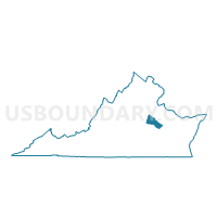
Outline

Summary
| Unique Area Identifier | 681820 |
| Name | Farrington Voting District |
| County | Hanover County |
| State | Virginia |
| Area (square miles) | 33.33 |
| Land Area (square miles) | 33.04 |
| Water Area (square miles) | 0.29 |
| % of Land Area | 99.12 |
| % of Water Area | 0.88 |
| Latitude of the Internal Point | 37.74494870 |
| Longtitude of the Internal Point | -77.57922090 |
Maps


Graphs
Select a template below for downloading or customizing gragh for Farrington Voting District, Hanover County, Virginia


Neighbors
Neighoring Voting District (by Name) Neighboring Voting District on the Map
- Centerville Voting District, Goochland County, VA
- Elmont Voting District, Hanover County, VA
- Glen Allen Voting District, Henrico County, VA
- Montpelier Voting District, Hanover County, VA
- Rivers Edge Voting District, Henrico County, VA
- Rockville Voting District, Hanover County, VA
- Shady Grove Voting District, Henrico County, VA
- Wilmington Parish Voting District, Hanover County, VA
Top 10 Neighboring County Subdivision (by Population) Neighboring County Subdivision on the Map
- Three Chopt district, Henrico County, VA (72,035)
- Brookland district, Henrico County, VA (61,481)
- South Anna district, Hanover County, VA (14,069)
- Beaverdam district, Hanover County, VA (12,879)
- District 4, Goochland County, VA (4,267)
Top 10 Neighboring Place (by Population) Neighboring Place on the Map
Top 10 Neighboring Unified School District (by Population) Neighboring Unified School District on the Map
- Henrico County Public Schools, VA (306,935)
- Hanover County Public Schools, VA (99,863)
- Goochland County Public Schools, VA (21,717)
Top 10 Neighboring State Legislative District Lower Chamber (by Population) Neighboring State Legislative District Lower Chamber on the Map
- State House District 56, VA (95,097)
- State House District 72, VA (81,778)
- State House District 55, VA (81,482)
Top 10 Neighboring State Legislative District Upper Chamber (by Population) Neighboring State Legislative District Upper Chamber on the Map
Top 10 Neighboring 111th Congressional District (by Population) Neighboring 111th Congressional District on the Map
Top 10 Neighboring Census Tract (by Population) Neighboring Census Tract on the Map
- Census Tract 2001.29, Henrico County, VA (11,764)
- Census Tract 2004.06, Henrico County, VA (8,986)
- Census Tract 2001.30, Henrico County, VA (7,140)
- Census Tract 3201, Hanover County, VA (6,367)
- Census Tract 4001, Goochland County, VA (6,228)
- Census Tract 3202, Hanover County, VA (5,891)
- Census Tract 3204, Hanover County, VA (4,428)
- Census Tract 3203, Hanover County, VA (4,061)
- Census Tract 3205, Hanover County, VA (3,001)