


Gates Voting District, Chesterfield County, Virginia
About
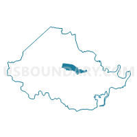
Outline

Summary
| Unique Area Identifier | 681319 |
| Name | Gates Voting District |
| County | Chesterfield County |
| State | Virginia |
| Area (square miles) | 8.05 |
| Land Area (square miles) | 7.97 |
| Water Area (square miles) | 0.08 |
| % of Land Area | 99.05 |
| % of Water Area | 0.95 |
| Latitude of the Internal Point | 37.39027450 |
| Longtitude of the Internal Point | -77.54744520 |
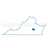
Maps

Graphs
Select a template below for downloading or customizing gragh for Gates Voting District, Chesterfield County, Virginia


Neighbors
Neighoring Voting District (by Name) Neighboring Voting District on the Map
- Bailey Bridge Voting District, Chesterfield County, VA
- Beach Voting District, Chesterfield County, VA
- Bird Voting District, Chesterfield County, VA
- Crenshaw Voting District, Chesterfield County, VA
- Five Forks Voting District, Chesterfield County, VA
- Iron Bridge Voting District, Chesterfield County, VA
- Nash Voting District, Chesterfield County, VA
- S. Manchester Voting District, Chesterfield County, VA
- Salem Church Voting District, Chesterfield County, VA
Top 10 Neighboring County Subdivision (by Population) Neighboring County Subdivision on the Map
- Matoaca district, Chesterfield County, VA (74,985)
- Bermuda district, Chesterfield County, VA (66,596)
- Dale district, Chesterfield County, VA (60,229)
- Clover Hill district, Chesterfield County, VA (55,546)
Top 10 Neighboring Unified School District (by Population) Neighboring Unified School District on the Map
Top 10 Neighboring State Legislative District Lower Chamber (by Population) Neighboring State Legislative District Lower Chamber on the Map
- State House District 66, VA (88,542)
- State House District 27, VA (87,915)
- State House District 62, VA (76,461)
Top 10 Neighboring State Legislative District Upper Chamber (by Population) Neighboring State Legislative District Upper Chamber on the Map
Top 10 Neighboring 111th Congressional District (by Population) Neighboring 111th Congressional District on the Map
Top 10 Neighboring Census Tract (by Population) Neighboring Census Tract on the Map
- Census Tract 1009.34, Chesterfield County, VA (6,316)
- Census Tract 1008.12, Chesterfield County, VA (5,807)
- Census Tract 1008.22, Chesterfield County, VA (5,084)
- Census Tract 1008.23, Chesterfield County, VA (5,075)
- Census Tract 1008.21, Chesterfield County, VA (4,673)
- Census Tract 1008.16, Chesterfield County, VA (4,636)
- Census Tract 1008.17, Chesterfield County, VA (3,530)
- Census Tract 1008.14, Chesterfield County, VA (3,524)
- Census Tract 1010.13, Chesterfield County, VA (3,289)
- Census Tract 1008.20, Chesterfield County, VA (2,580)