


Rock Spring Voting District, Arlington County, Virginia
About
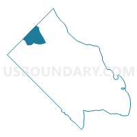
Outline

Summary
| Unique Area Identifier | 681081 |
| Name | Rock Spring Voting District |
| County | Arlington County |
| State | Virginia |
| Area (square miles) | 0.88 |
| Land Area (square miles) | 0.88 |
| Water Area (square miles) | 0.00 |
| % of Land Area | 99.99 |
| % of Water Area | 0.01 |
| Latitude of the Internal Point | 38.91080800 |
| Longtitude of the Internal Point | -77.14198870 |
Maps


Graphs
Select a template below for downloading or customizing gragh for Rock Spring Voting District, Arlington County, Virginia


Neighbors
Neighoring Voting District (by Name) Neighboring Voting District on the Map
- Chesterbrook Voting District, Fairfax County, VA
- El Nido Voting District, Fairfax County, VA
- Madison Voting District, Arlington County, VA
- Marshall Voting District, Arlington County, VA
- Nottingham Voting District, Arlington County, VA
- Yorktown Voting District, Arlington County, VA
Top 10 Neighboring County Subdivision (by Population) Neighboring County Subdivision on the Map
Top 10 Neighboring Place (by Population) Neighboring Place on the Map
Top 10 Neighboring Unified School District (by Population) Neighboring Unified School District on the Map
Top 10 Neighboring State Legislative District Lower Chamber (by Population) Neighboring State Legislative District Lower Chamber on the Map
Top 10 Neighboring State Legislative District Upper Chamber (by Population) Neighboring State Legislative District Upper Chamber on the Map
Top 10 Neighboring 111th Congressional District (by Population) Neighboring 111th Congressional District on the Map
Top 10 Neighboring Census Tract (by Population) Neighboring Census Tract on the Map
- Census Tract 4709, Fairfax County, VA (7,263)
- Census Tract 1003, Arlington County, VA (6,213)
- Census Tract 1002, Arlington County, VA (6,019)
- Census Tract 1001, Arlington County, VA (4,672)
- Census Tract 4703, Fairfax County, VA (3,253)