


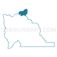
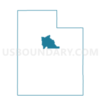
Alpine 1 Voting District, Utah County, Utah
About
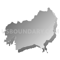
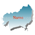
Outline

Summary
| Unique Area Identifier | 680151 |
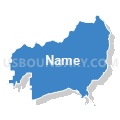
| Name | Alpine 1 Voting District |
| County | Utah County |
| State | Utah |
| Area (square miles) | 70.41 |
| Land Area (square miles) | 70.30 |
| Water Area (square miles) | 0.11 |
| % of Land Area | 99.85 |
| % of Water Area | 0.15 |
| Latitude of the Internal Point | 40.52794200 |
| Longtitude of the Internal Point | -111.65456760 |
Maps

Graphs
Select a template below for downloading or customizing gragh for Alpine 1 Voting District, Utah County, Utah


Neighbors
Neighoring Voting District (by Name) Neighboring Voting District on the Map
- Voting District 4790, Salt Lake County, UT
- Voting District 9431, Salt Lake County, UT
- Alpine 2 Voting District, Utah County, UT
- Alpine 3 Voting District, Utah County, UT
- Alpine 4 Voting District, Utah County, UT
- Alpine 5 Voting District, Utah County, UT
- Draper 1 Voting District, Utah County, UT
- Highland 4 Voting District, Utah County, UT
- Highland 5 Voting District, Utah County, UT
- Provo Canyon Voting District, Utah County, UT
- Wasatch County - West Voting District, Wasatch County, UT
- z Unpopulated 4804, Salt Lake County, UT
Top 10 Neighboring County Subdivision (by Population) Neighboring County Subdivision on the Map
- Salt Lake City CCD, Salt Lake County, UT (932,320)
- American Fork-Pleasant Grove CCD, Utah County, UT (121,452)
- Heber City West CCD, Wasatch County, UT (8,133)
- Cottonwood CCD, Salt Lake County, UT (4,427)
- North Wasatch CCD, Wasatch County, UT (2,086)
Top 10 Neighboring Place (by Population) Neighboring Place on the Map
Top 10 Neighboring Unified School District (by Population) Neighboring Unified School District on the Map
- Alpine School District, UT (284,505)
- Canyons School District, UT (204,224)
- Wasatch School District, UT (23,530)
Top 10 Neighboring State Legislative District Lower Chamber (by Population) Neighboring State Legislative District Lower Chamber on the Map
- State House District 27, UT (49,237)
- State House District 54, UT (42,563)
- State House District 62, UT (32,162)
- State House District 46, UT (28,377)
- State House District 48, UT (28,348)
Top 10 Neighboring State Legislative District Upper Chamber (by Population) Neighboring State Legislative District Upper Chamber on the Map
- State Senate District 11, UT (137,882)
- State Senate District 26, UT (101,392)
- State Senate District 16, UT (82,618)
- State Senate District 9, UT (76,707)
- State Senate District 8, UT (74,996)
Top 10 Neighboring 111th Congressional District (by Population) Neighboring 111th Congressional District on the Map
Top 10 Neighboring Census Tract (by Population) Neighboring Census Tract on the Map
- Census Tract 102.20, Utah County, UT (5,972)
- Census Tract 9604, Wasatch County, UT (5,092)
- Census Tract 1128.15, Salt Lake County, UT (5,044)
- Census Tract 1101.02, Salt Lake County, UT (4,427)
- Census Tract 102.08, Utah County, UT (3,934)
- Census Tract 102.11, Utah County, UT (3,246)
- Census Tract 109, Utah County, UT (1,059)
Top 10 Neighboring 5-Digit ZIP Code Tabulation Area (by Population) Neighboring 5-Digit ZIP Code Tabulation Area on the Map
- 84604, UT (49,145)
- 84062, UT (43,269)
- 84003, UT (42,384)
- 84121, UT (41,702)
- 84092, UT (29,525)
- 84004, UT (9,818)
- 84049, UT (4,372)