


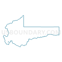
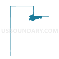
Prospector Voting District, Summit County, Utah
About
Outline

Summary
| Unique Area Identifier | 679981 |
| Name | Prospector Voting District |
| County | Summit County |
| State | Utah |
| Area (square miles) | 0.25 |
| Land Area (square miles) | 0.25 |
| Water Area (square miles) | 0.00 |
| % of Land Area | 100.00 |
| % of Water Area | 0.00 |
| Latitude of the Internal Point | 40.66169270 |
| Longtitude of the Internal Point | -111.49864830 |
Maps

Graphs
Select a template below for downloading or customizing gragh for Prospector Voting District, Summit County, Utah


Neighbors
Neighoring Voting District (by Name) Neighboring Voting District on the Map
- Deer Valley North Voting District, Summit County, UT
- Old Town North Voting District, Summit County, UT
- Park Meadows South Voting District, Summit County, UT
- Quarry Mountain Voting District, Summit County, UT
- Sidewinder Voting District, Summit County, UT
- Thaynes Canyon Voting District, Summit County, UT
Top 10 Neighboring County Subdivision (by Population) Neighboring County Subdivision on the Map
Top 10 Neighboring Place (by Population) Neighboring Place on the Map
Top 10 Neighboring Unified School District (by Population) Neighboring Unified School District on the Map
Top 10 Neighboring State Legislative District Lower Chamber (by Population) Neighboring State Legislative District Lower Chamber on the Map
Top 10 Neighboring State Legislative District Upper Chamber (by Population) Neighboring State Legislative District Upper Chamber on the Map
Top 10 Neighboring 111th Congressional District (by Population) Neighboring 111th Congressional District on the Map
Top 10 Neighboring Census Tract (by Population) Neighboring Census Tract on the Map
- Census Tract 9644.02, Summit County, UT (3,632)
- Census Tract 9643.08, Summit County, UT (2,960)
- Census Tract 9644.01, Summit County, UT (1,316)